What is 3d Laser Scanning ?
What is 3D Laser Scanning?
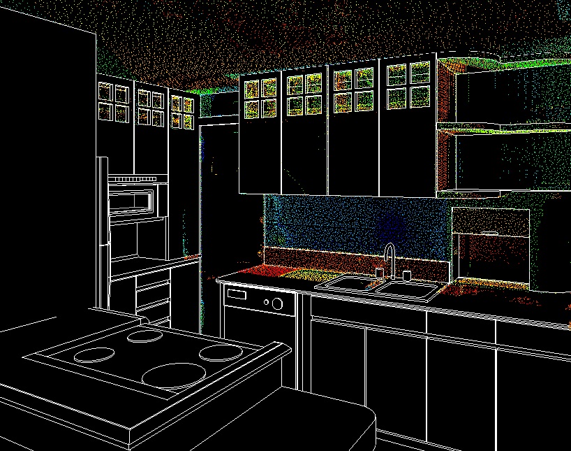
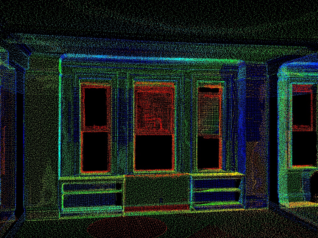
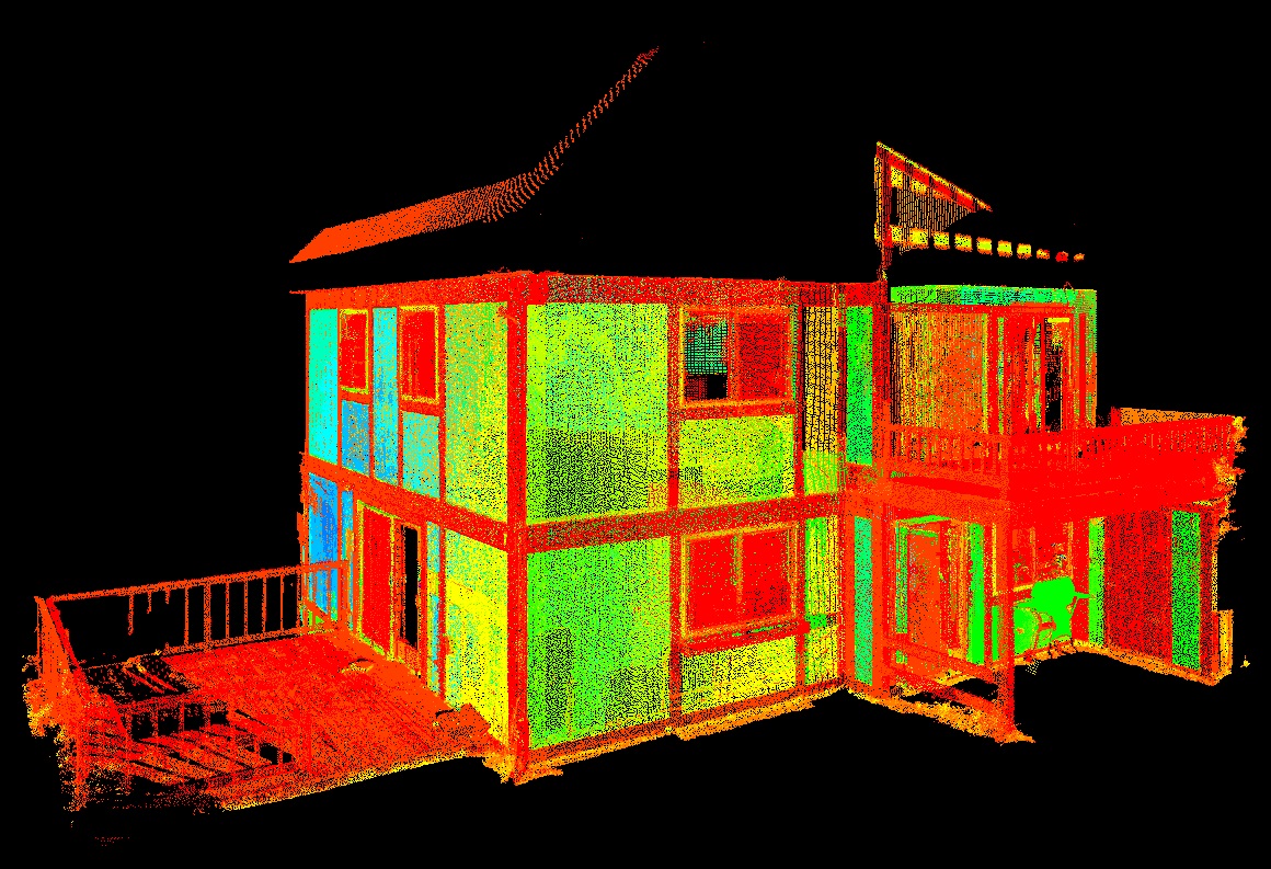
3d laser scanning is method of capturing spatial data and developing the data into highly detailed and dimensionally accurate as-built 2d plans, topography, 3d models, and scan to BIM models. Laser Scanning can also be referred to as Terrestrial LIDAR. LIDAR is an acronym - Light Detection And Ranging.
How Laser Scanning Works
What is a Laser Scanner?
A 3d Laser Scanner is a reality capture instrument that collects spatial information for a specific environment. Similar to a traditional Surveying Instrument (Electronic Total Station) it captures XYZ point information combined with reflective surface light intensity to create a 3D dimensionally accurate image. You can think of a Laser Scanner as an Electronic Total Station on steroids. A Laser Scanner collects a large amount of data very quickly. Scanners collect thousands of XYZ points per second where a Surveying Instrument collects single point XYZ data. The 3d scanner can operate in a variety of conditions including complete darkness, highly illuminated areas, active environments such as roadways and railways; congested and/or dangerous working conditions are typical examples.
The Laser Scanner works by emitting a Laser signal then computing either the time of flight or phase shift between the scanner and the object that is targeted to determine its relative position and surface light intensity. There are many types of Laser Scanners. In our work the two primary laser scanning technologies to capture point data are Phase Shift and Pulsed based.
Phase Shift - The distance to a particular object is calculated from the phase difference of a modulated laser signal. The received laser signal is compared to transmitted signal to determine the "shift" which can be used to calculate distance. Phase shift technology has range (60-90M) capability and data acquisition rates (500,000 + pts/sec.).
Pulsed Based - This is Time of Flight laser measurement. The transmitted laser signal is timed (based on the speed of light) after leaving the scanner hitting the object and then returned to the scanner. The time difference is used for distance calculation. Pulse Based technology has range capabilities (100-500 m) and data acquisition rates (500,000 to 1,000,000 pts/sec.).
The Laser Scanning Process.
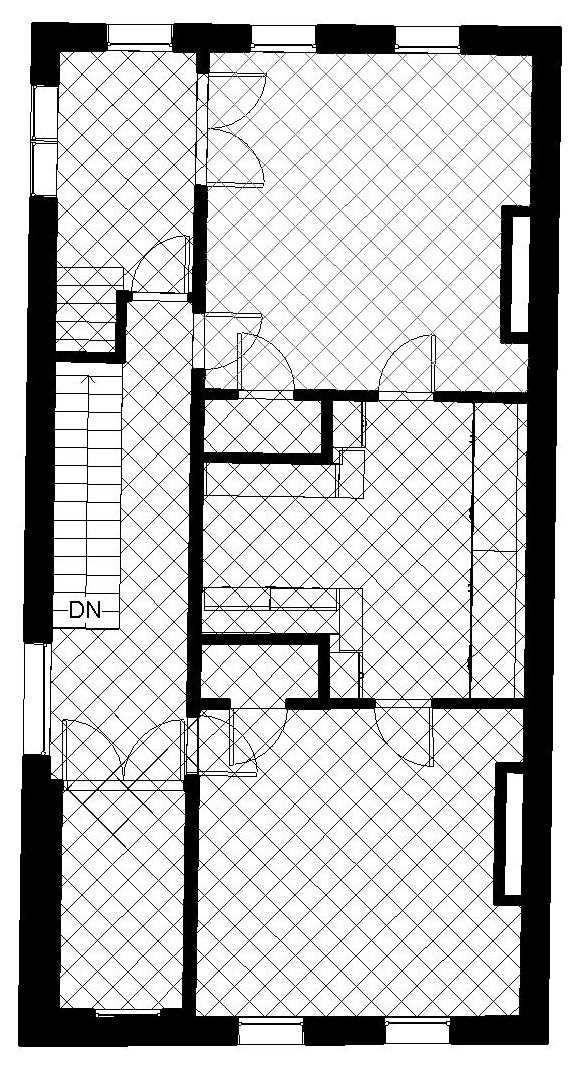
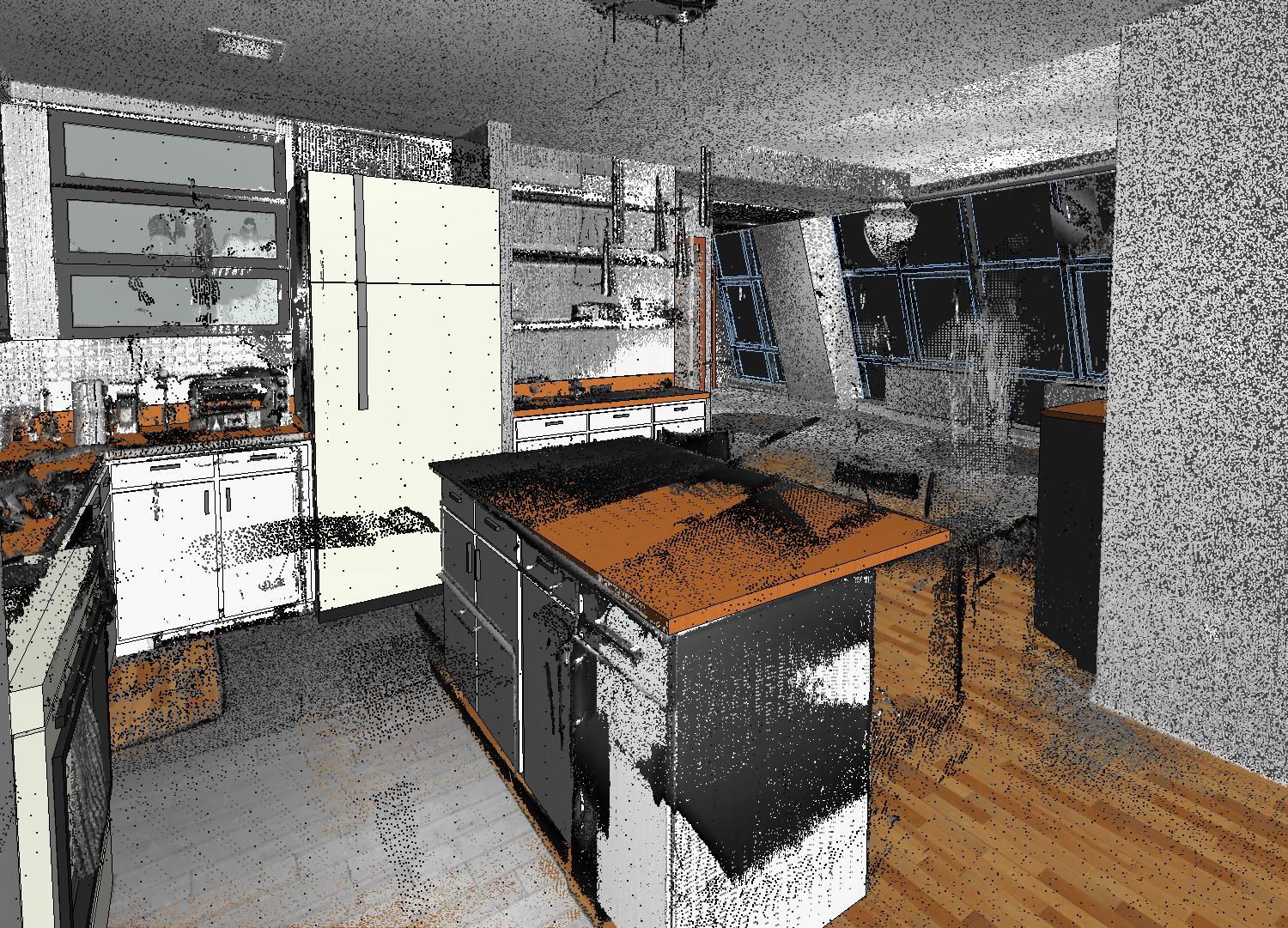
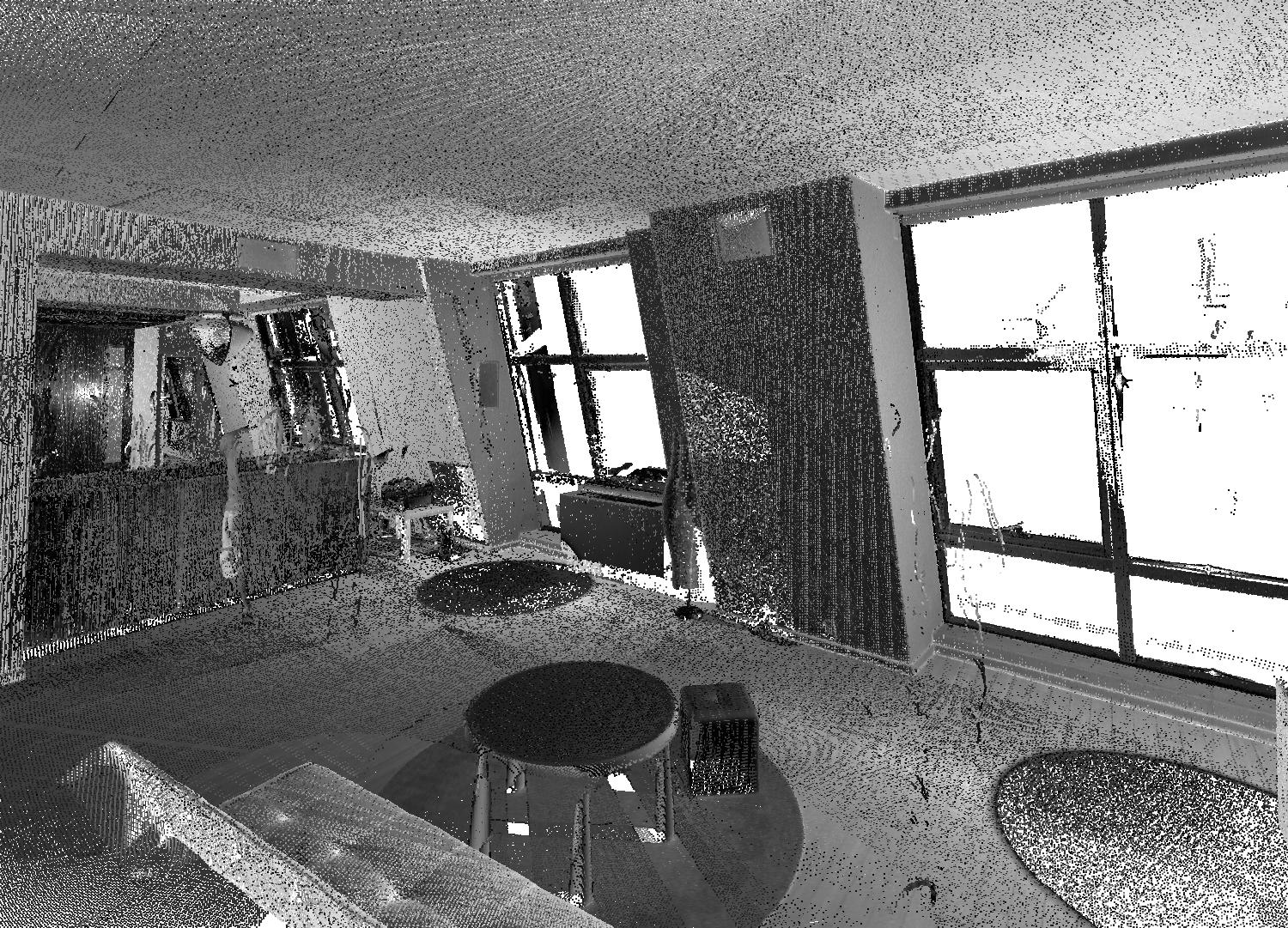
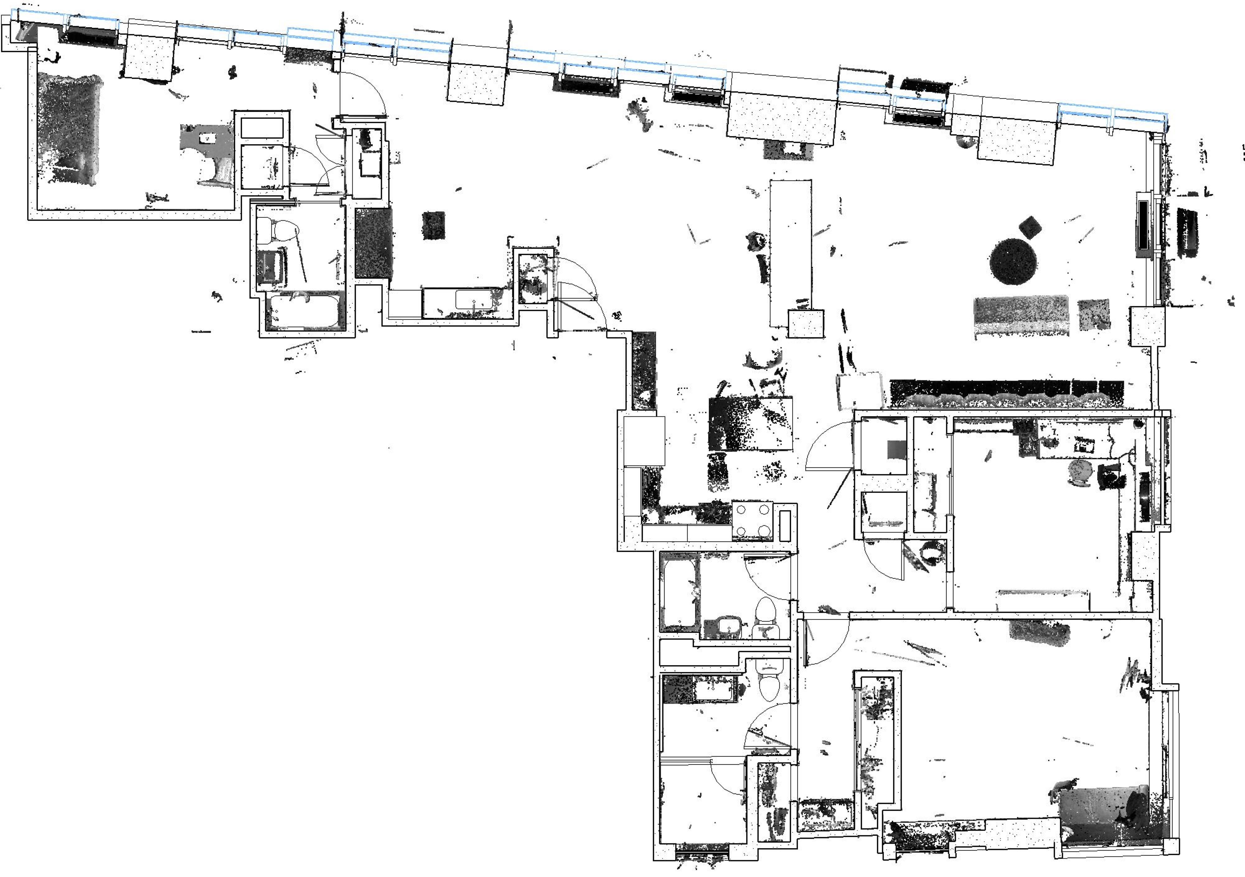
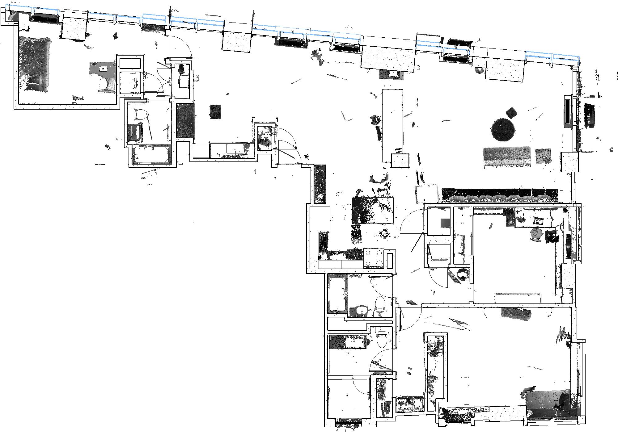
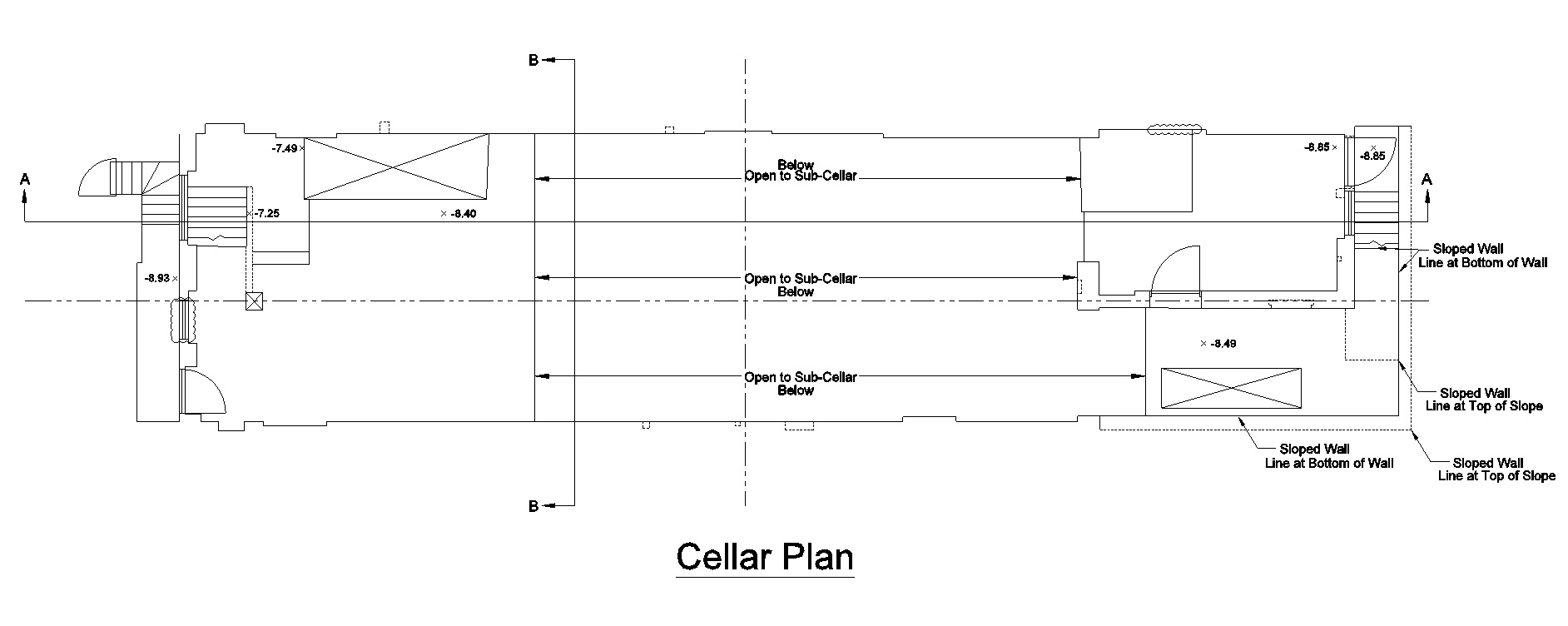
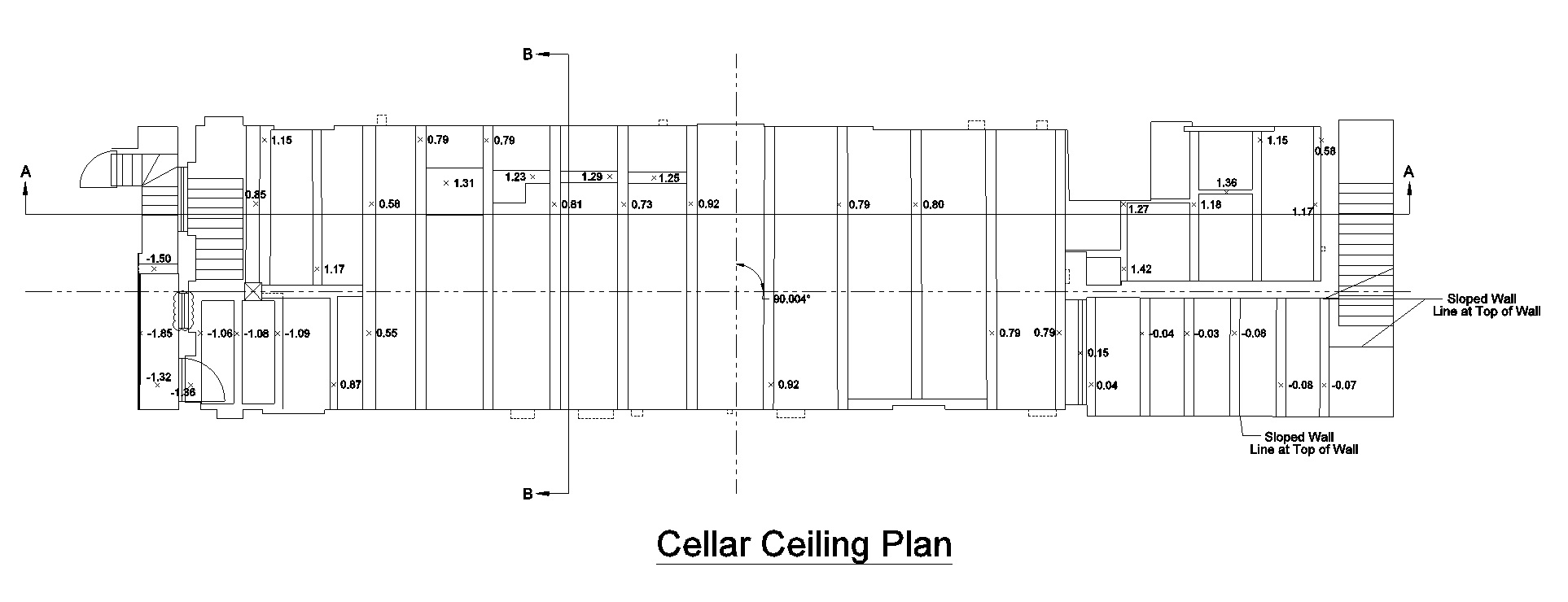
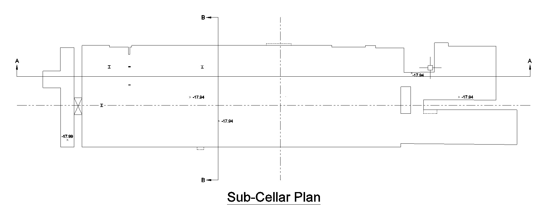
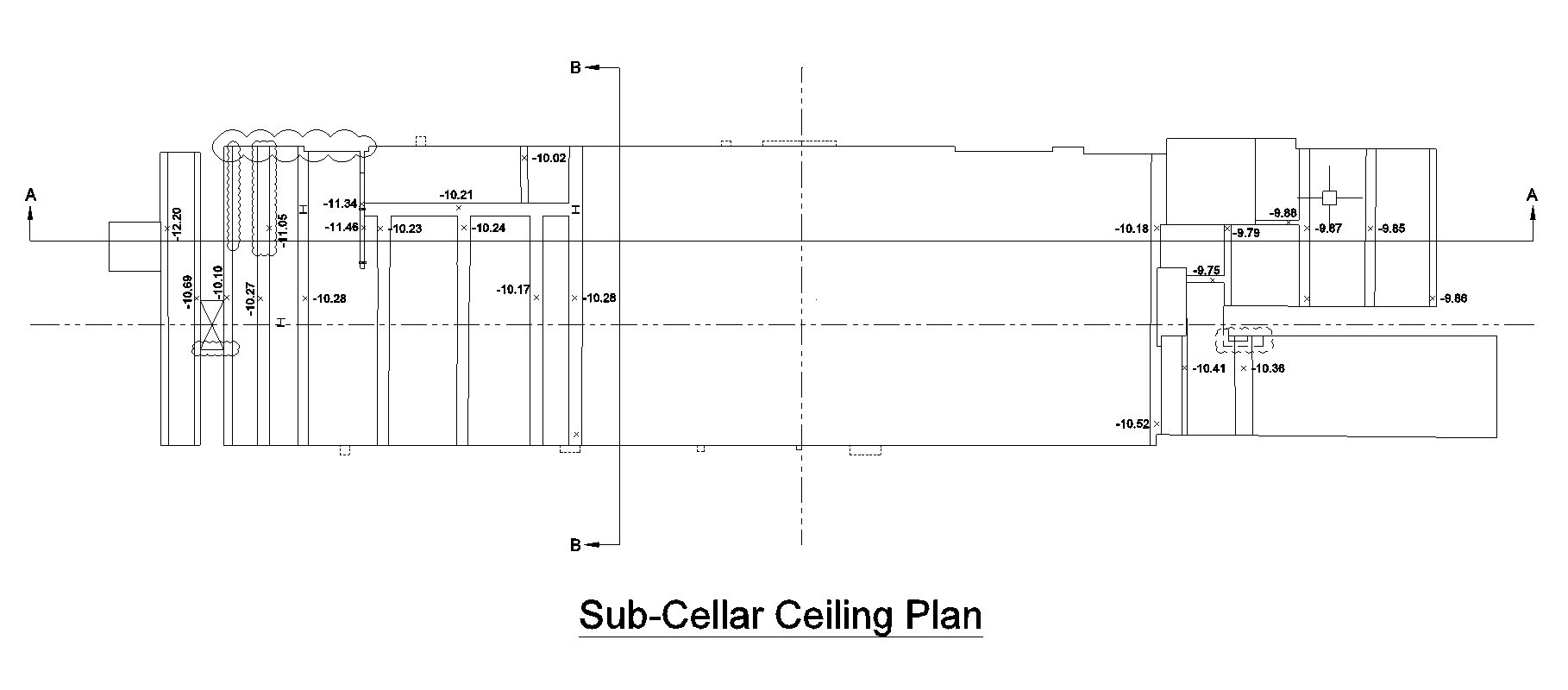
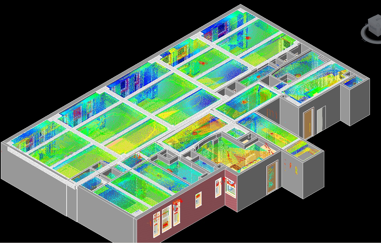
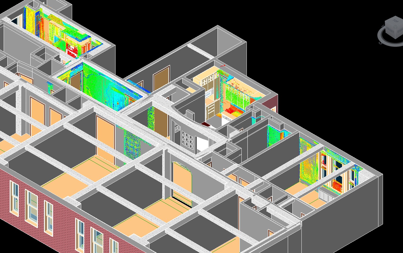
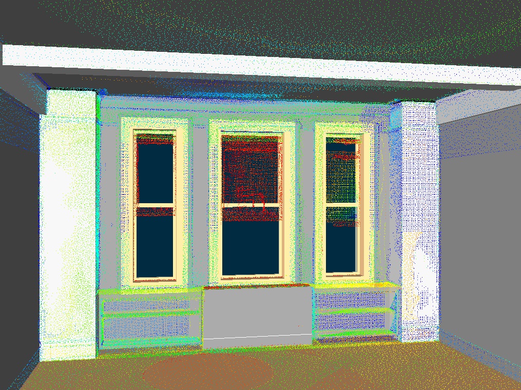
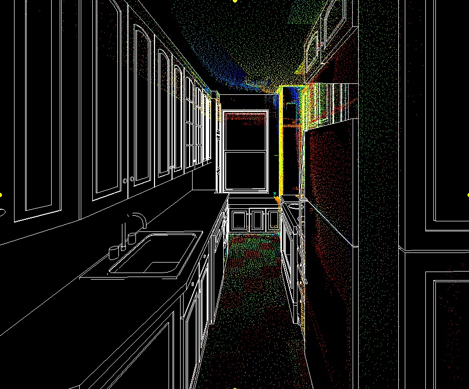
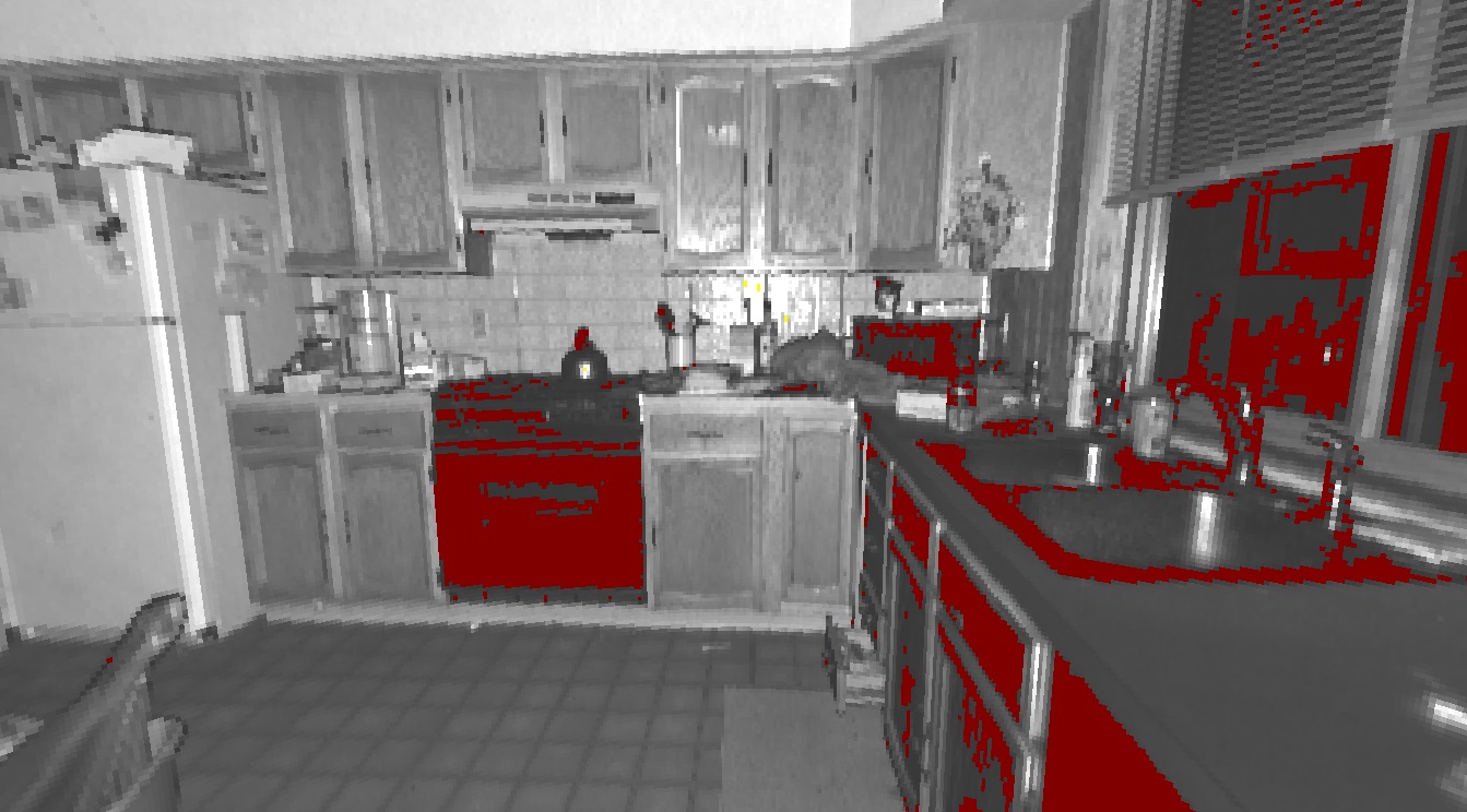
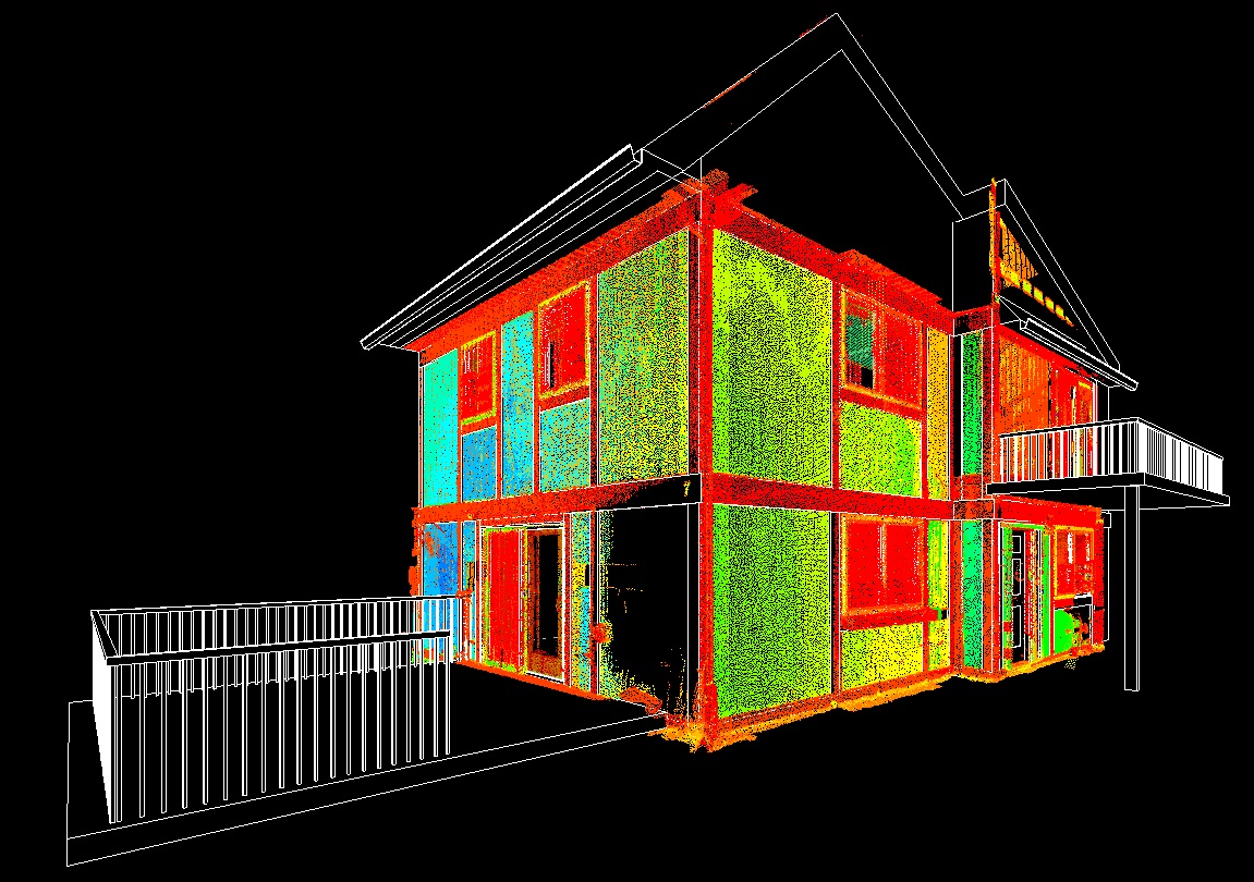
The 3d Laser Scanner collects a single scan of a pre-defined area with a certain level of detail appropriate for the particular project. The scan is typically referred to as a Point Cloud. The Point Cloud is essentially a highly detailed 3D picture that is measurable. Usually multiple scans are needed to create an overall image of the specific area. The multiple scans are then registered (combined) together with common points or targets within the individual scans creating a single 3D environment representing the entire project area. The project area can then be coordinated with a local or global coordinate system resulting in a highly detailed, accurate map.
Call Today: 607-327-1106
Email: cgibbons@gpassociates.org
Norfolk Street, Manhattan, NY
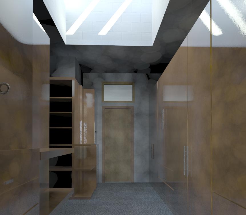
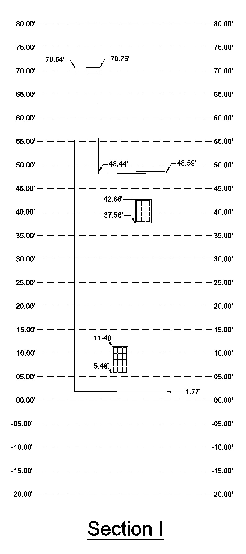
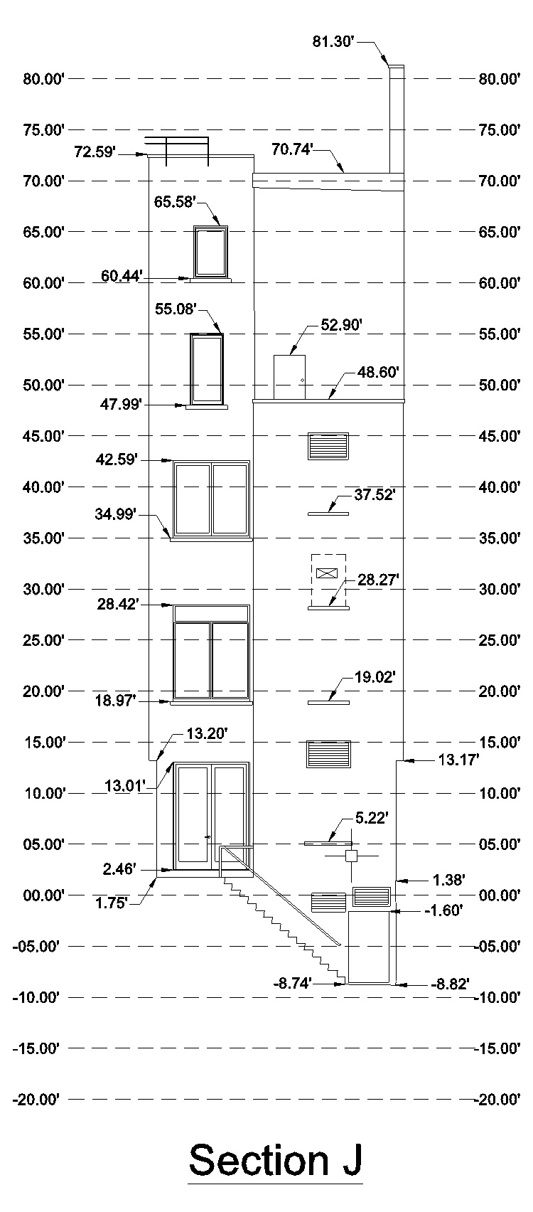
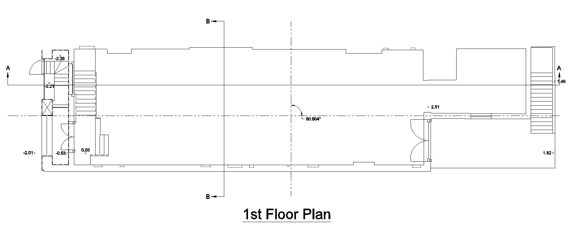
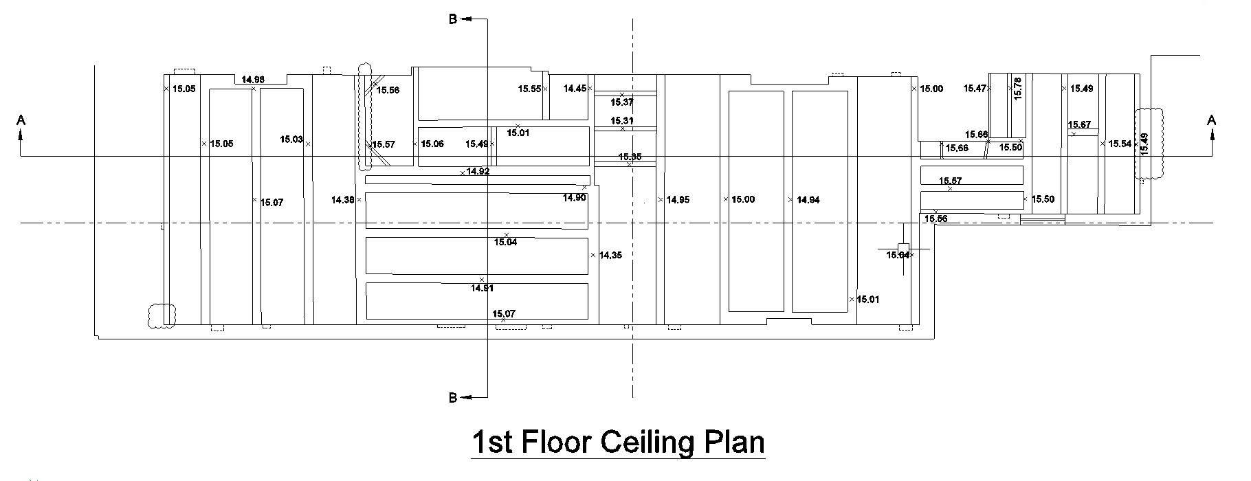
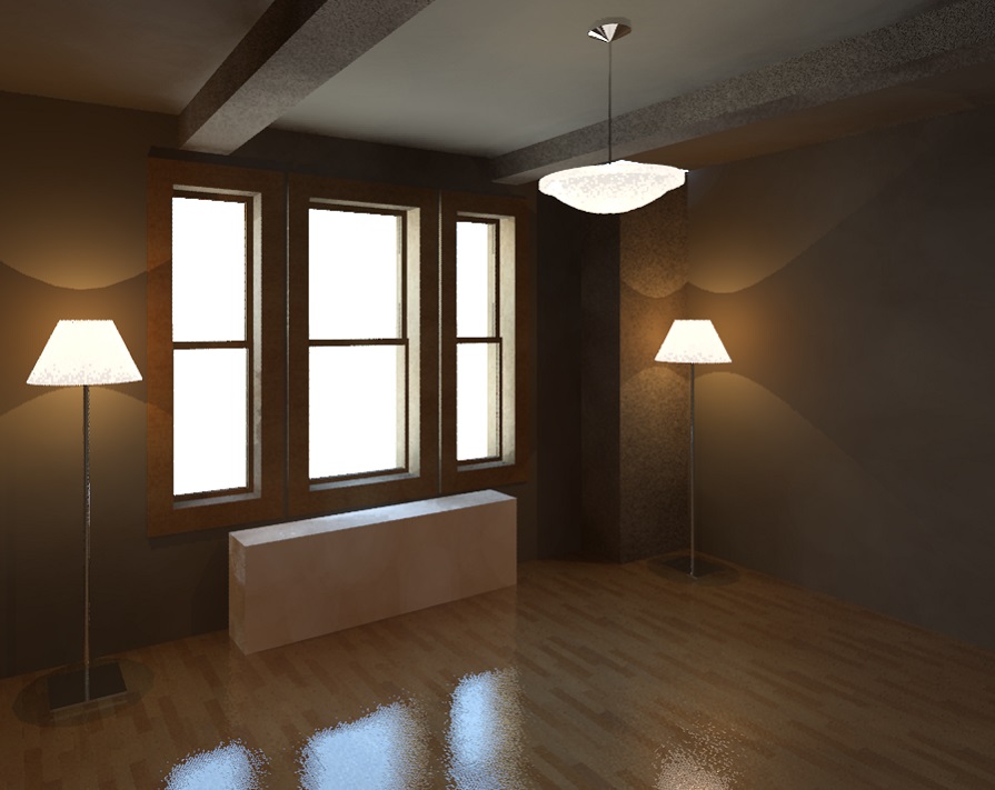
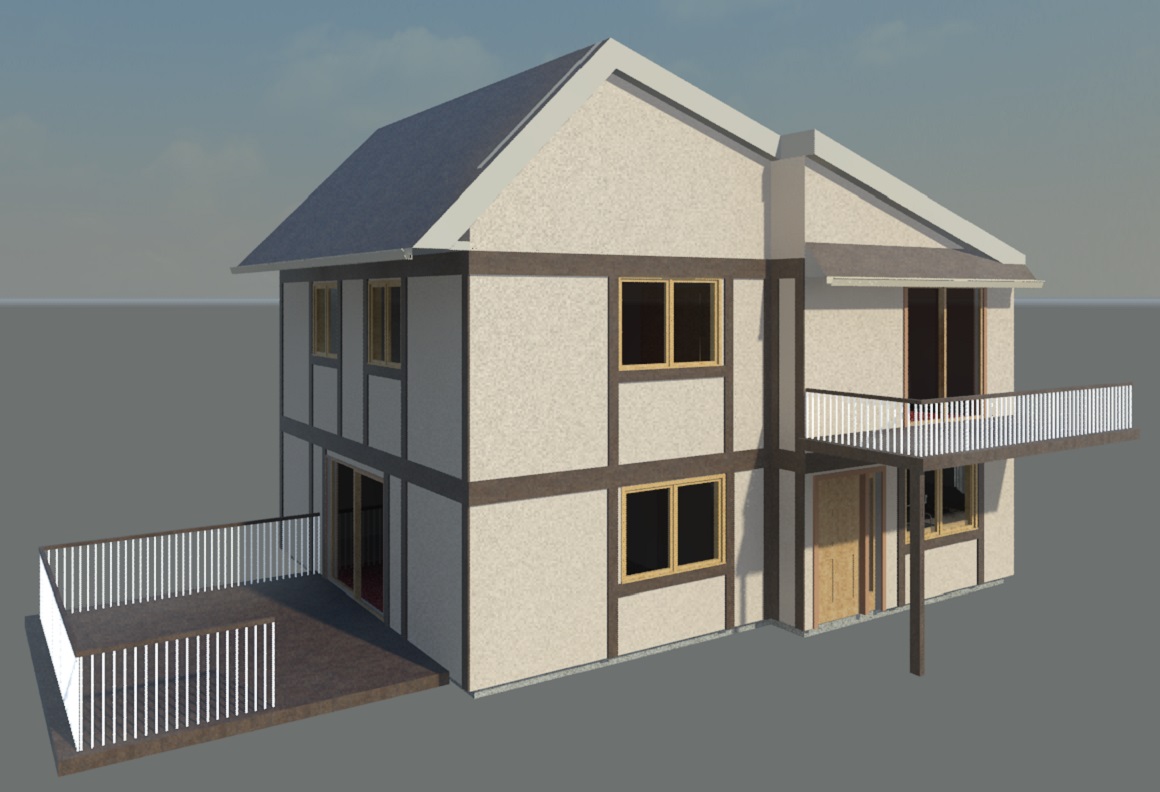
Type: Residential As-Built Projects
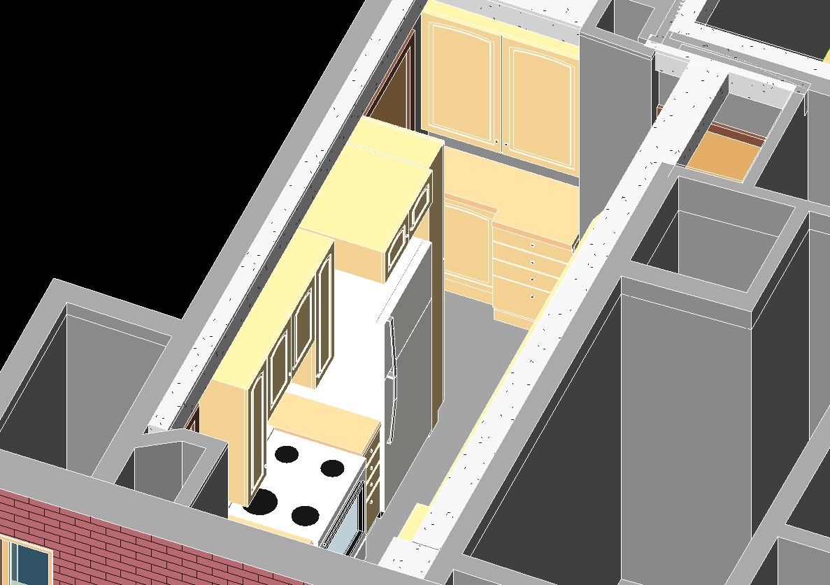
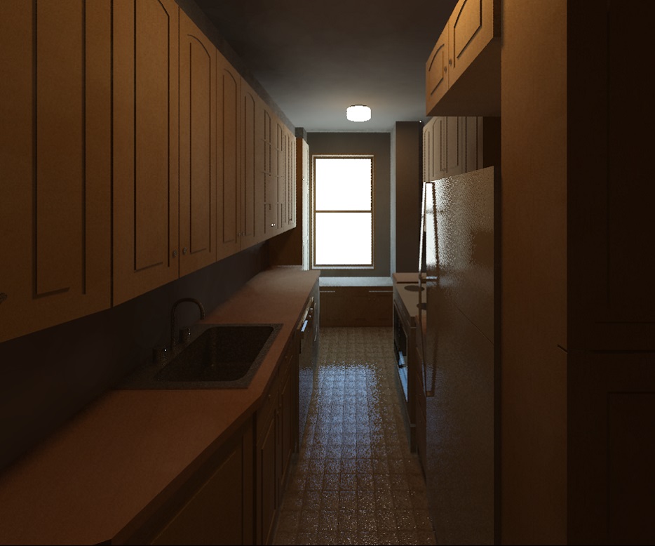
East 49th Street
Type: Residential As-Built Projects
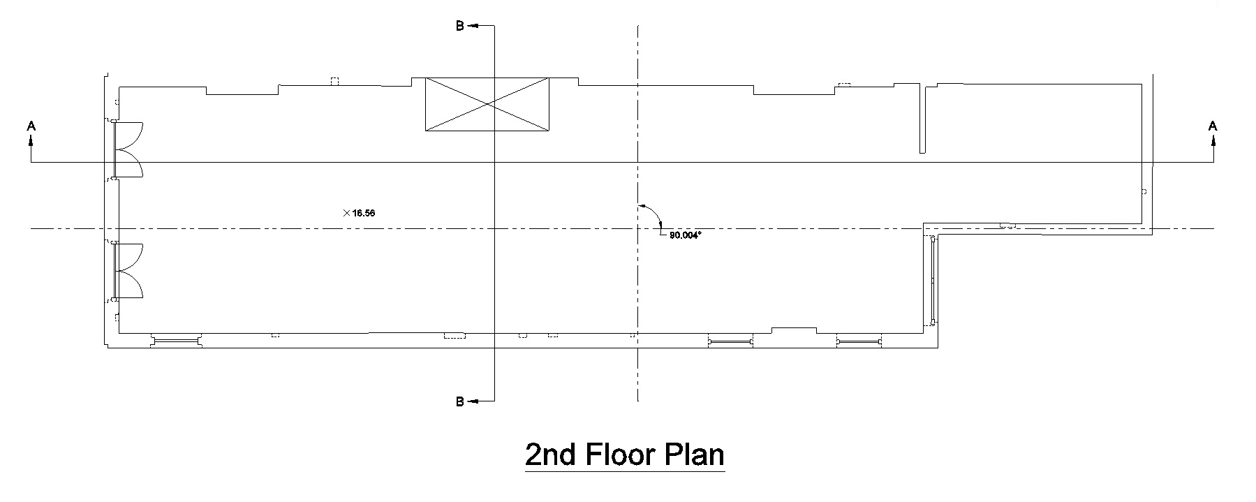
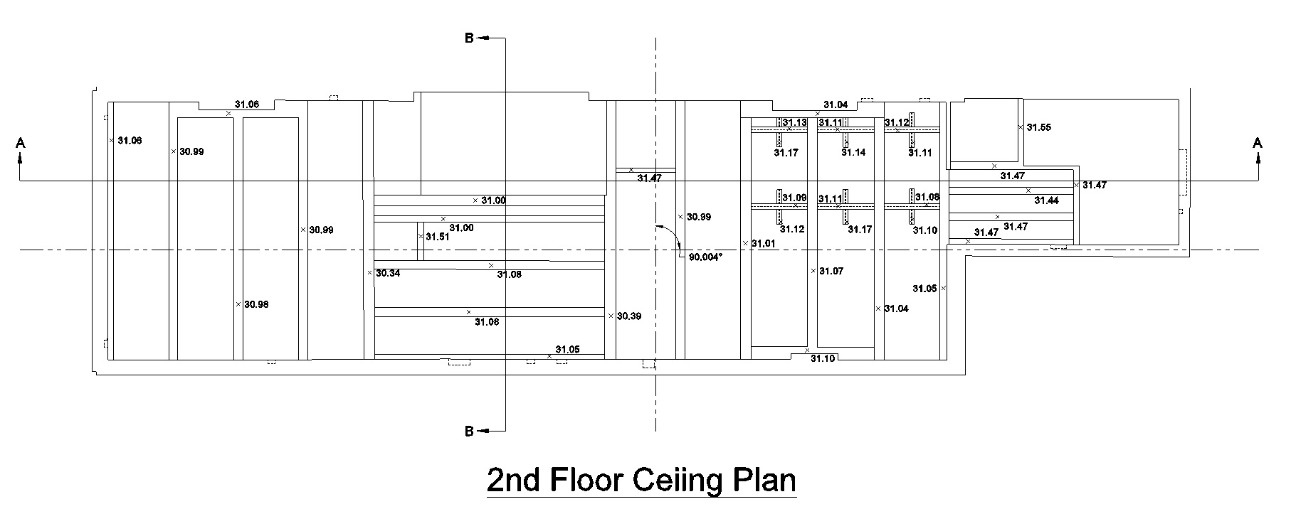
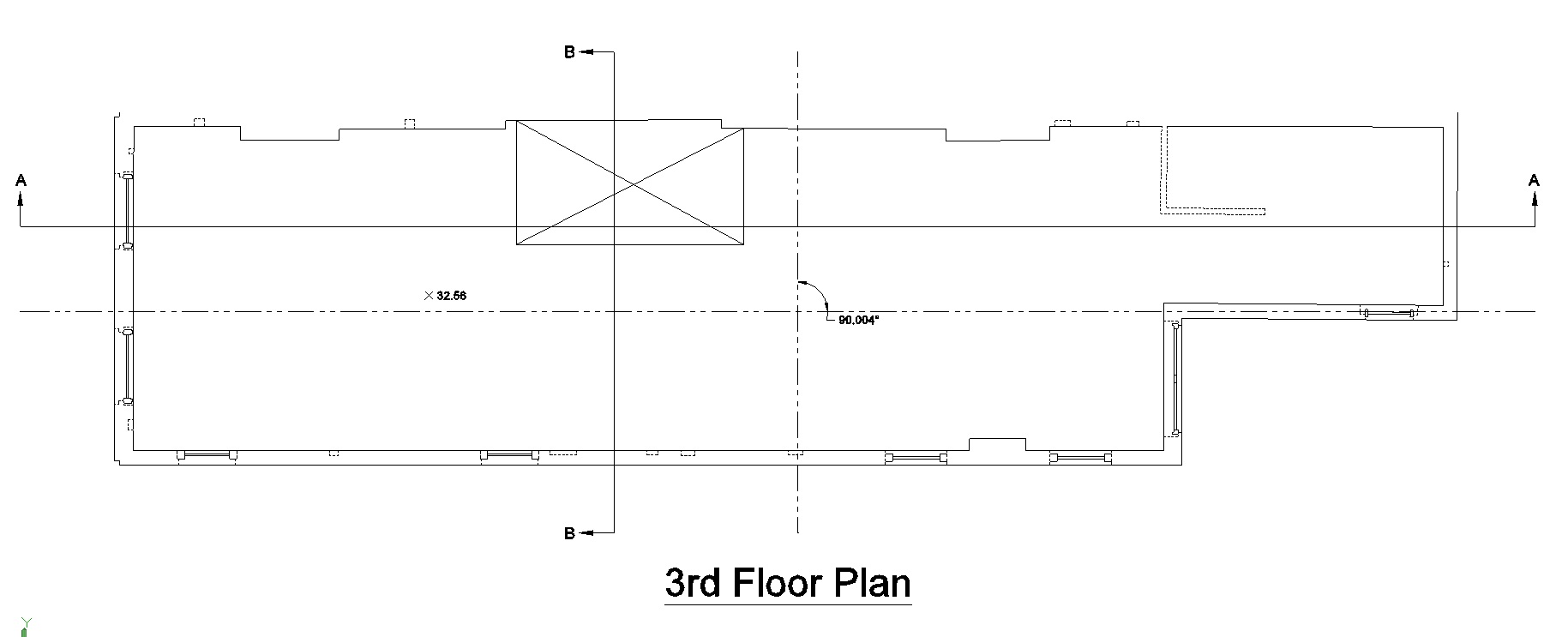
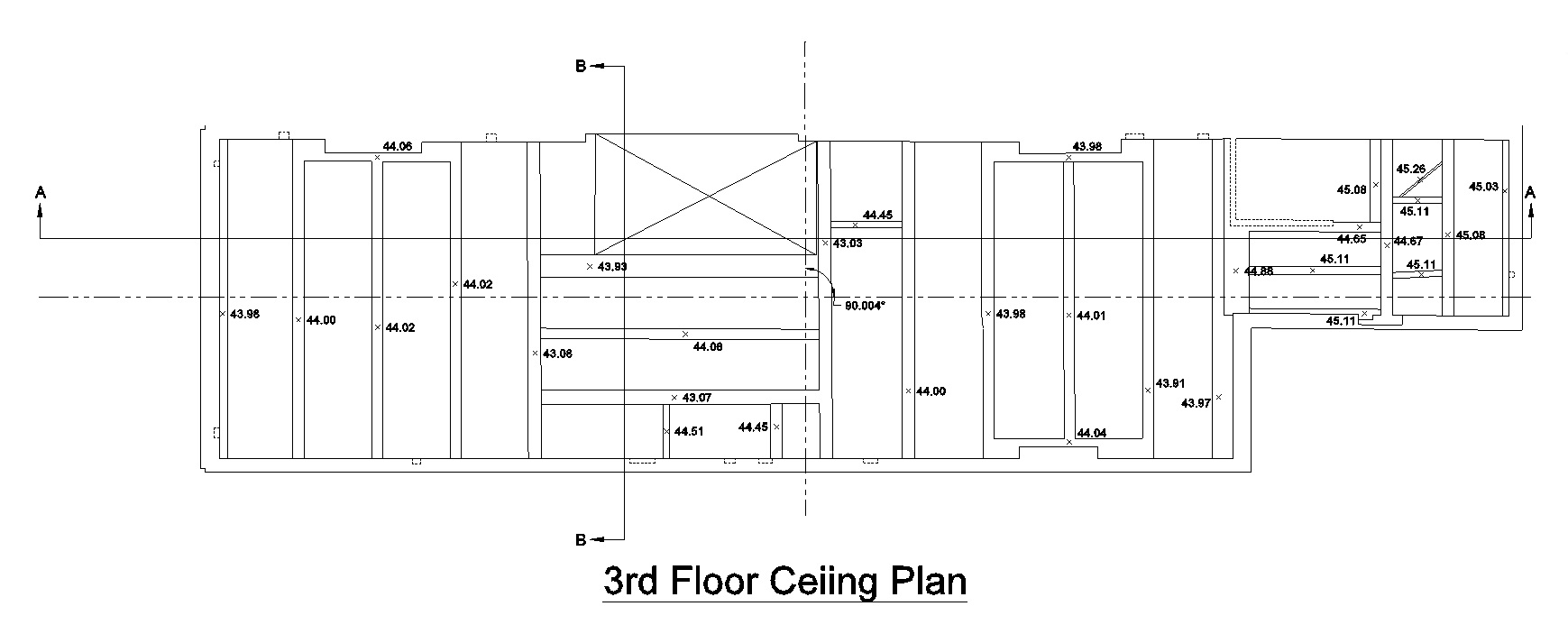
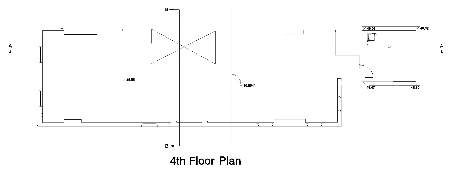
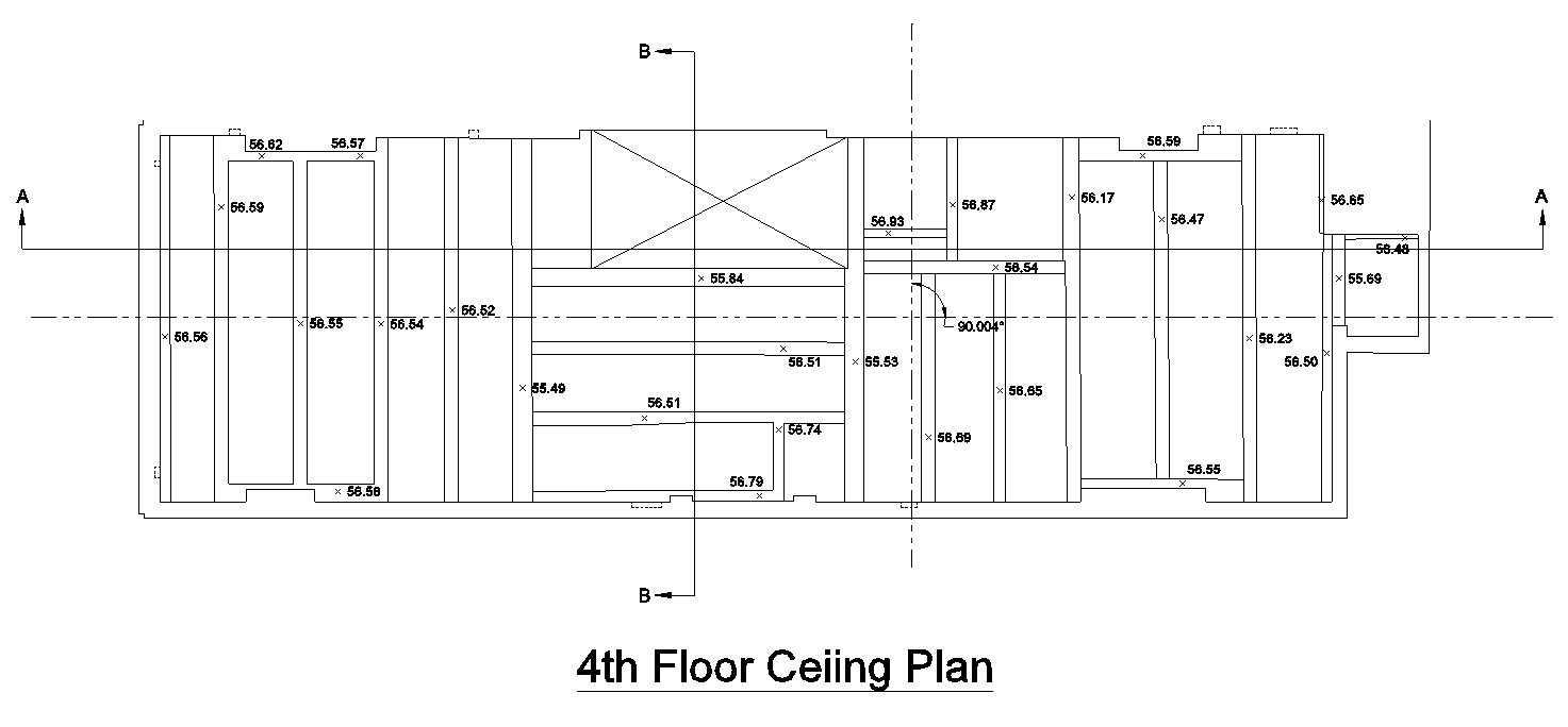
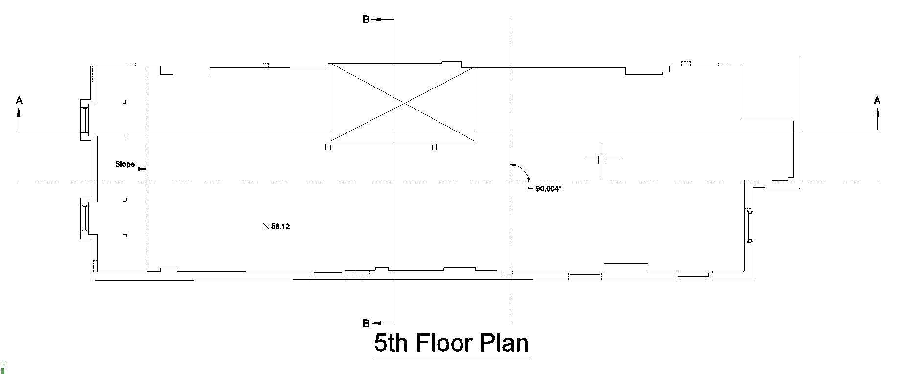
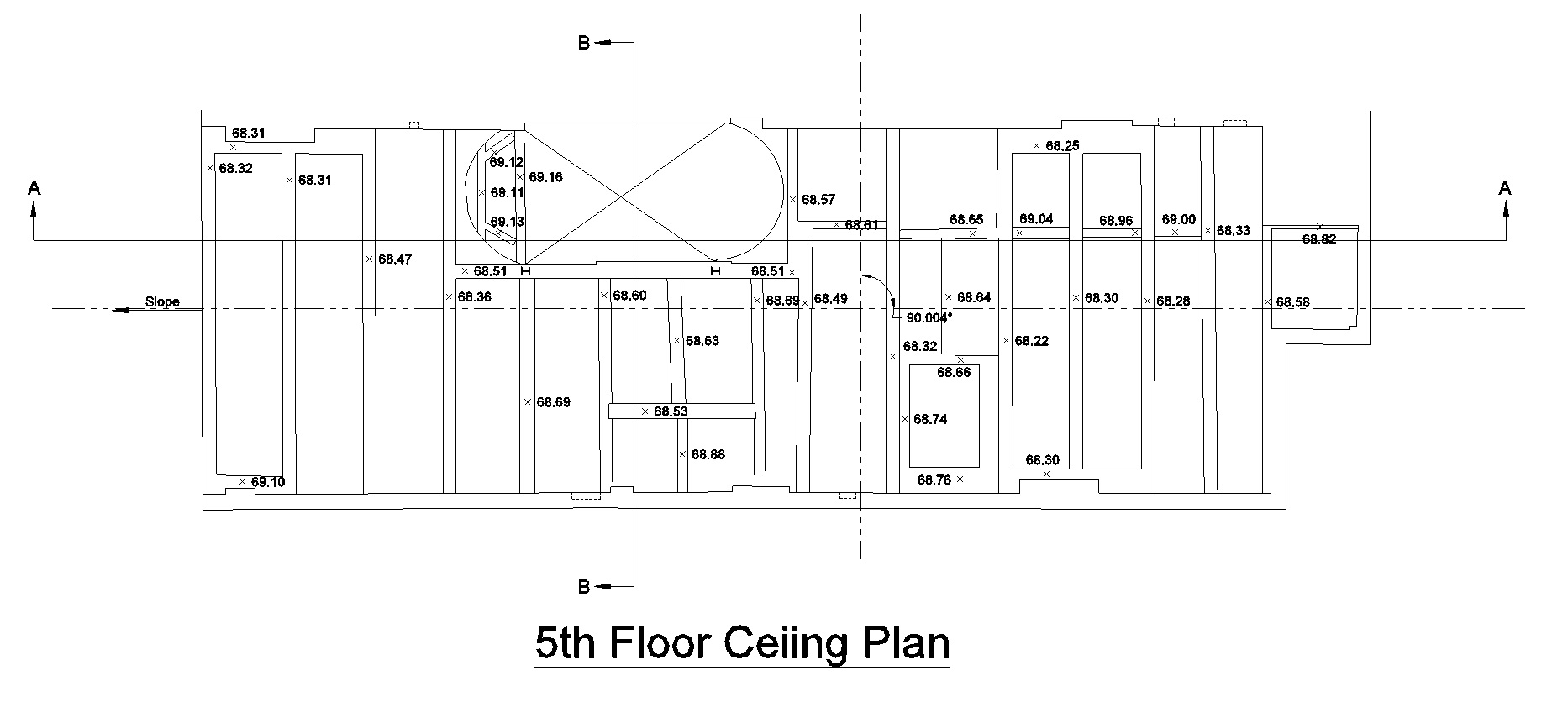
West End Avenue, NYC
Type: Residential As-Built Projects
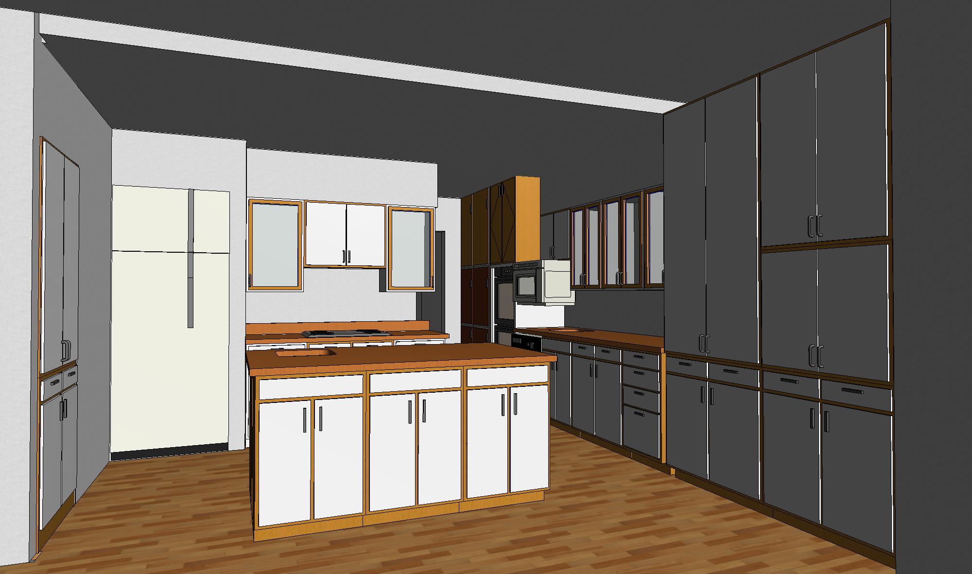
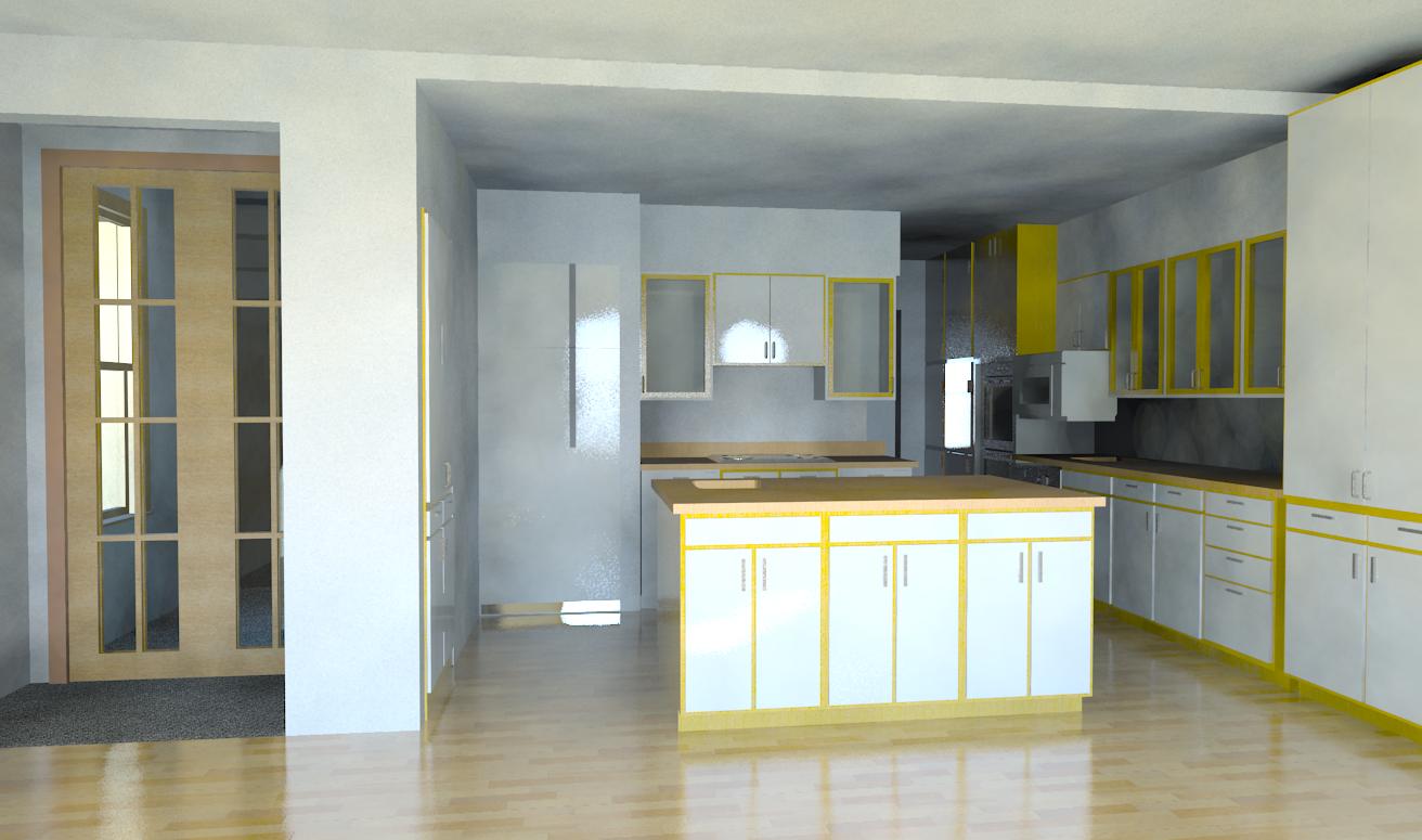
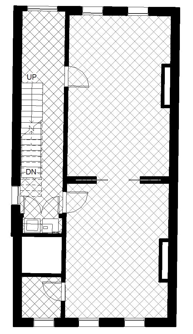
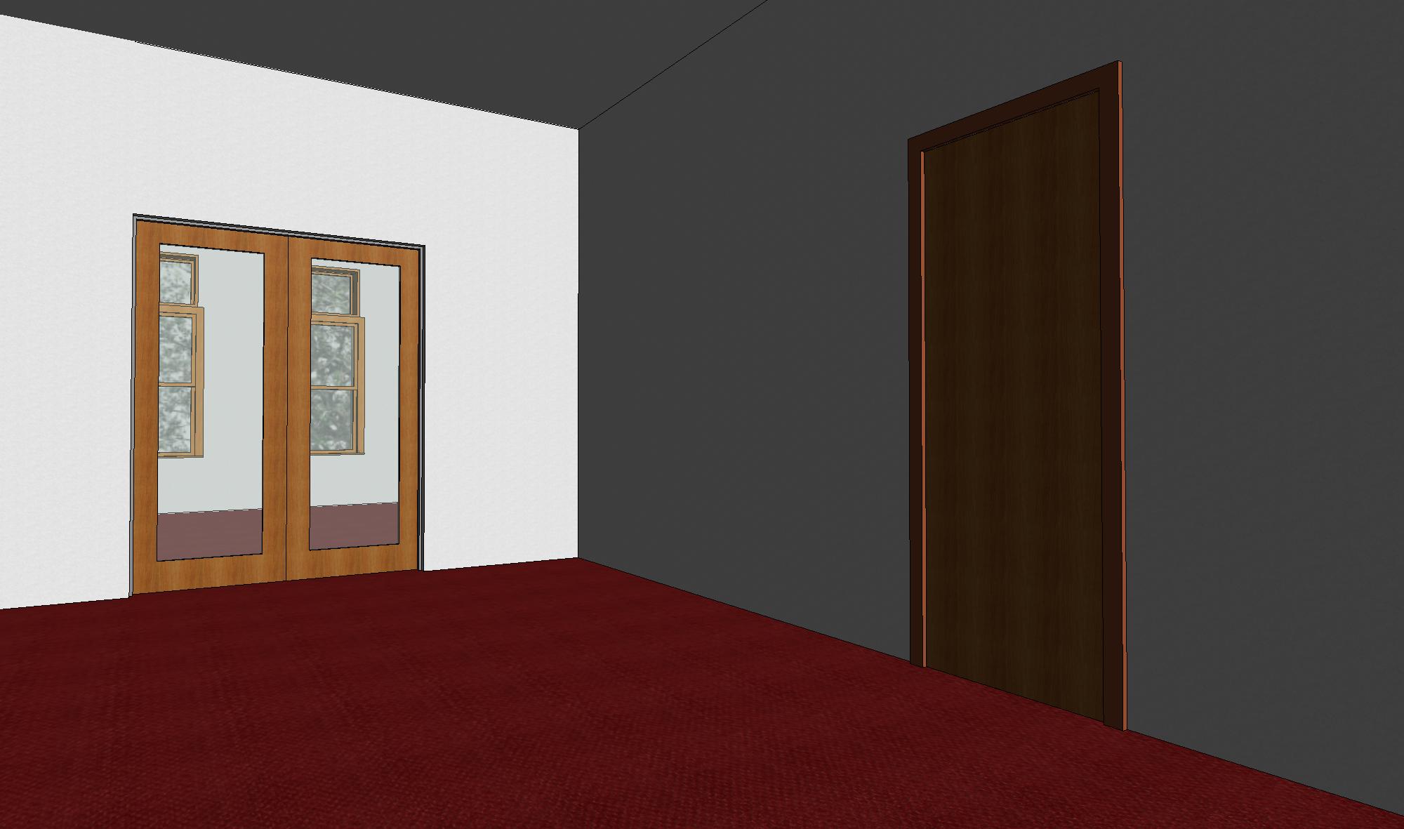
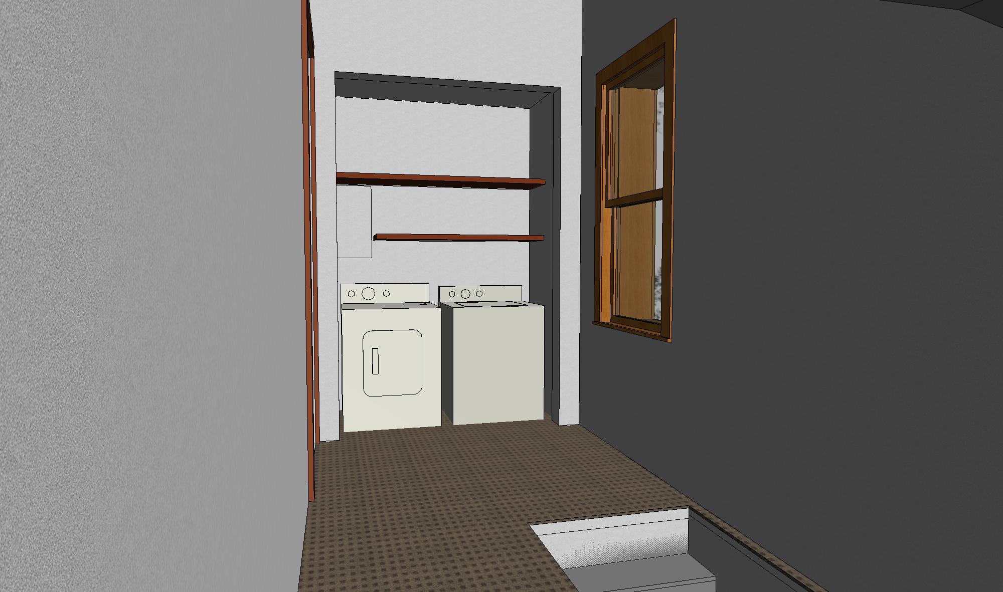
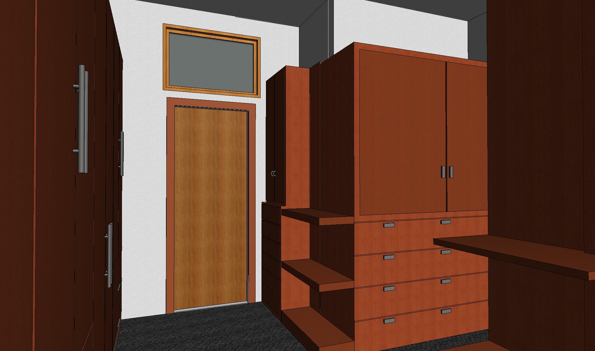
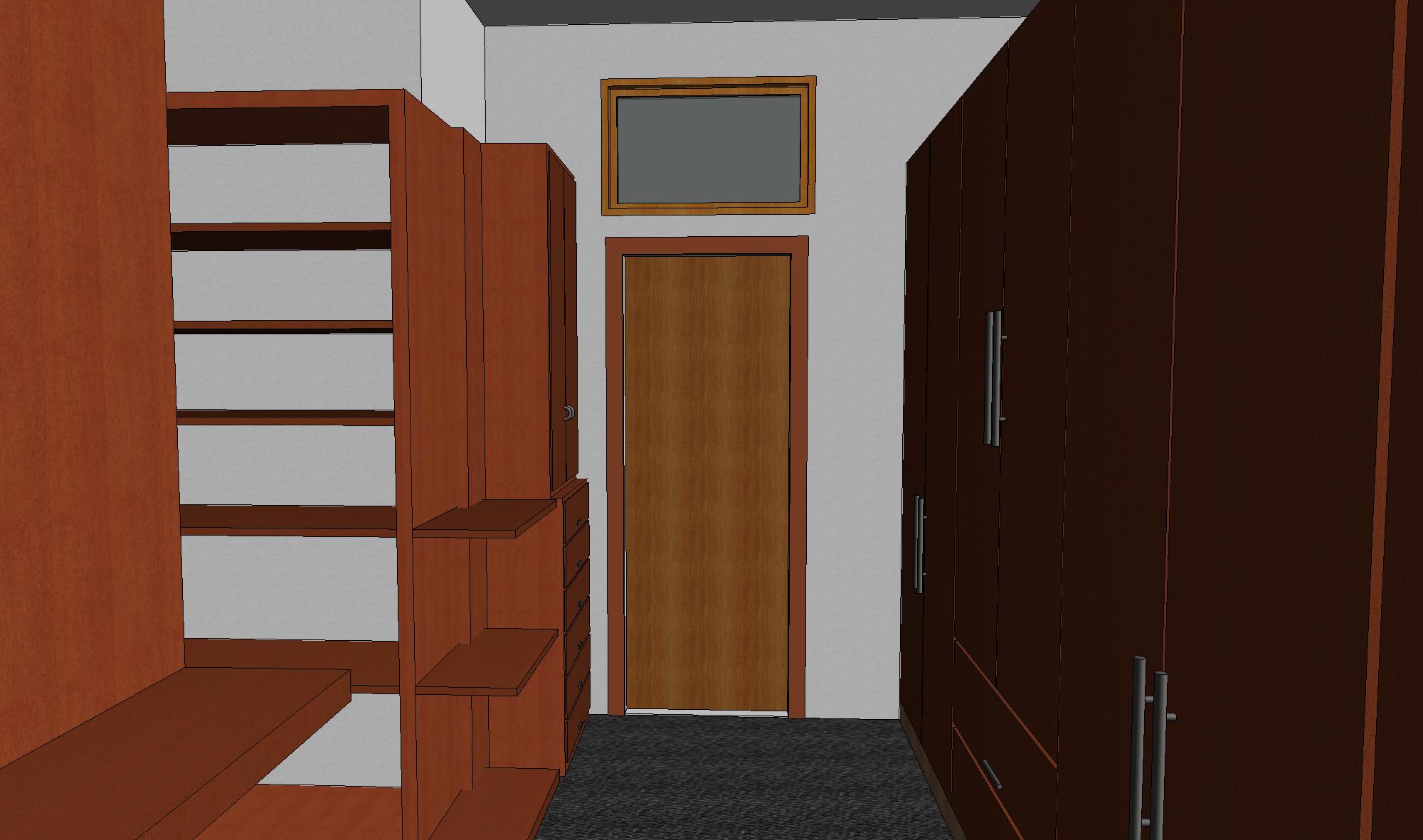
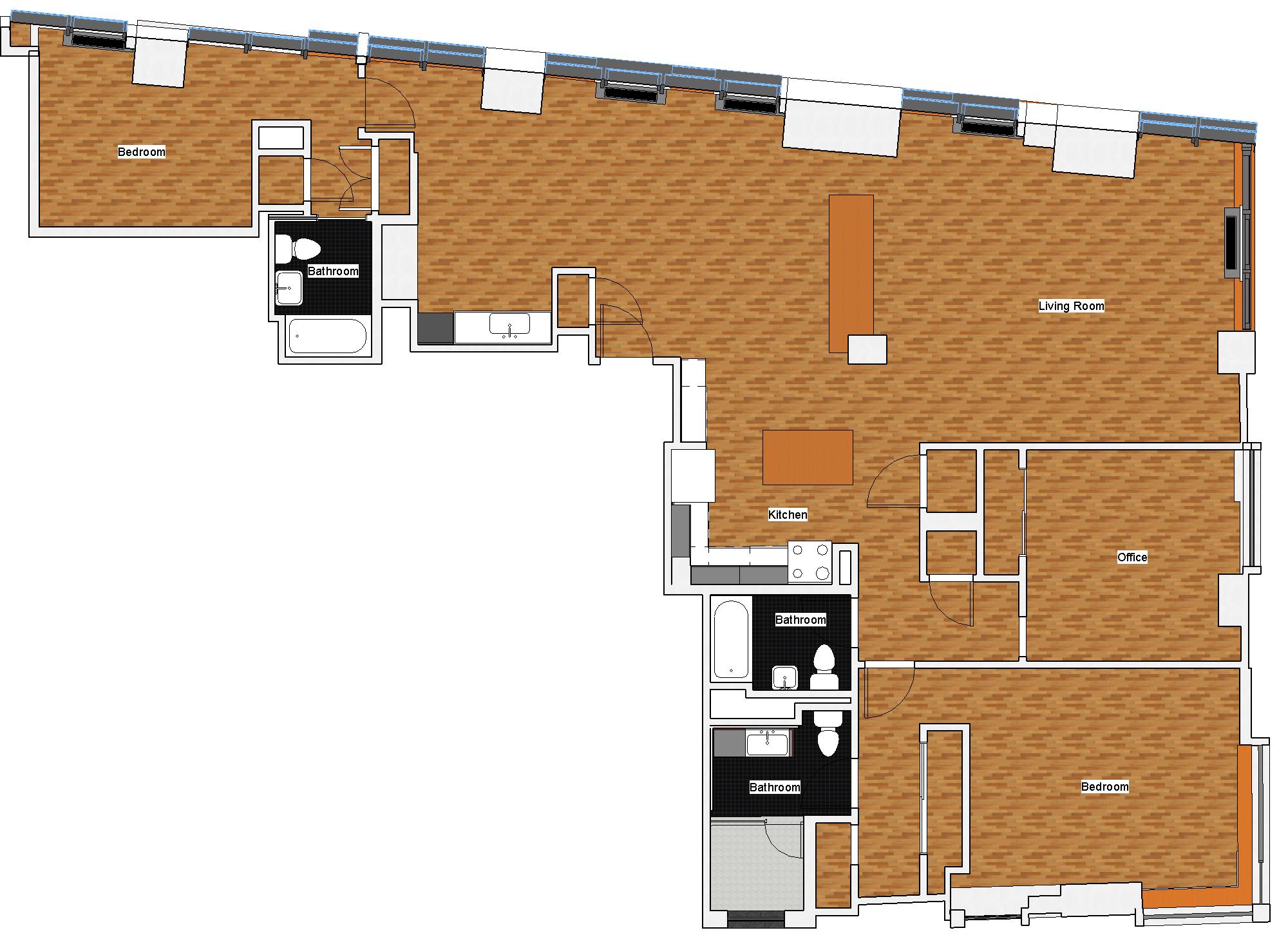
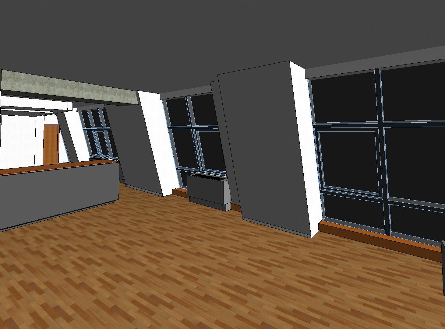
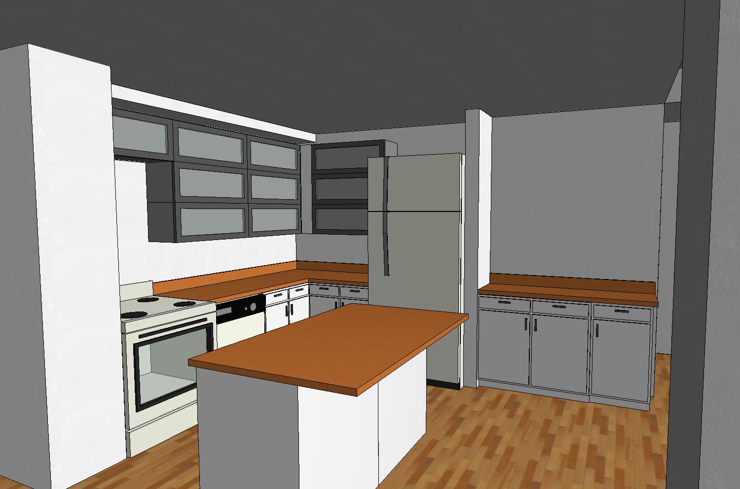
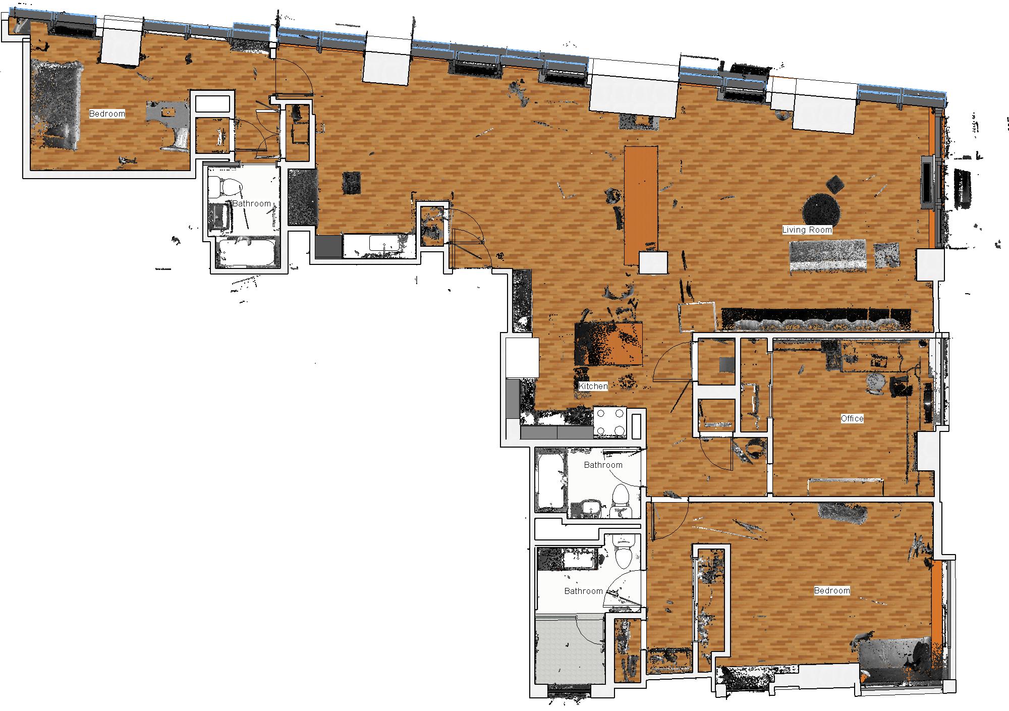
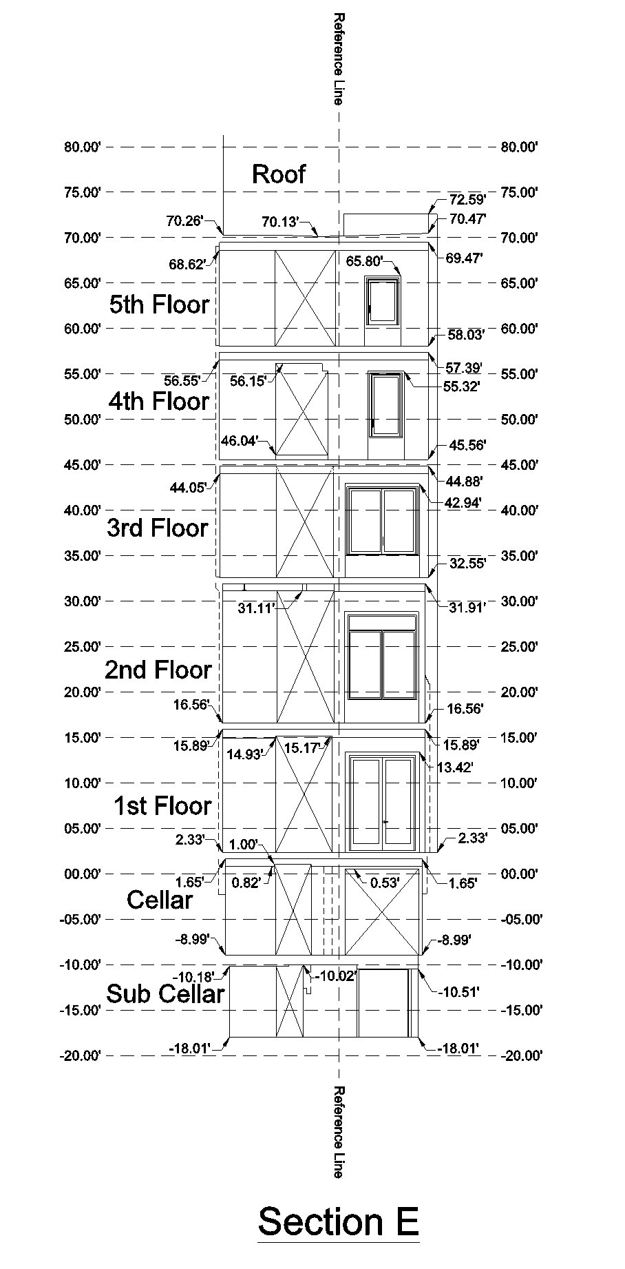
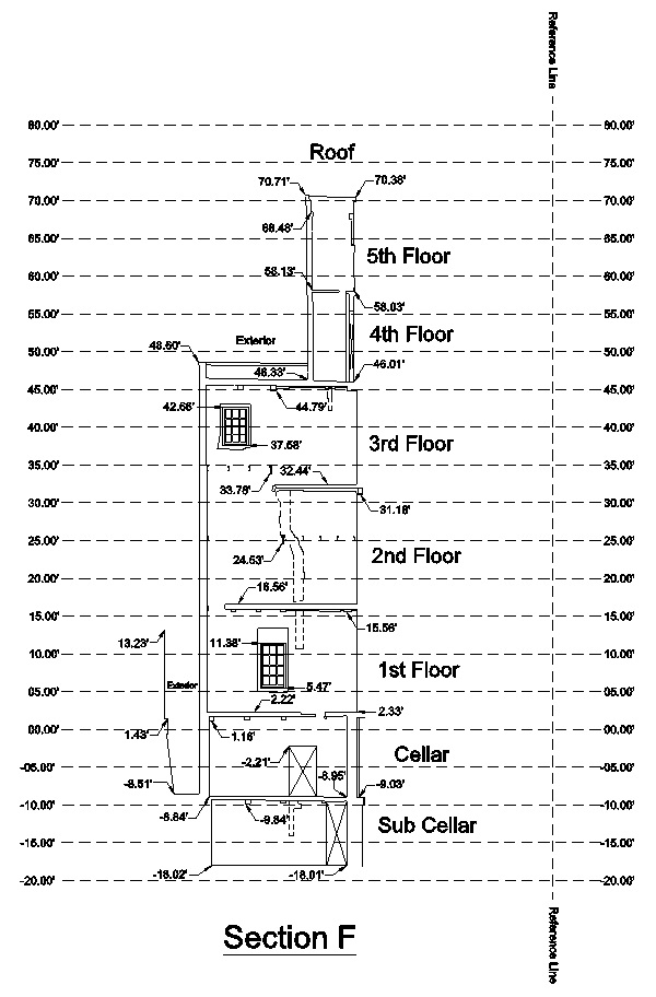
- Provided NYC 3d scanning services for two Manhattan apartments that where being combined into a singe residential unit.
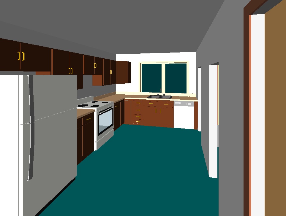
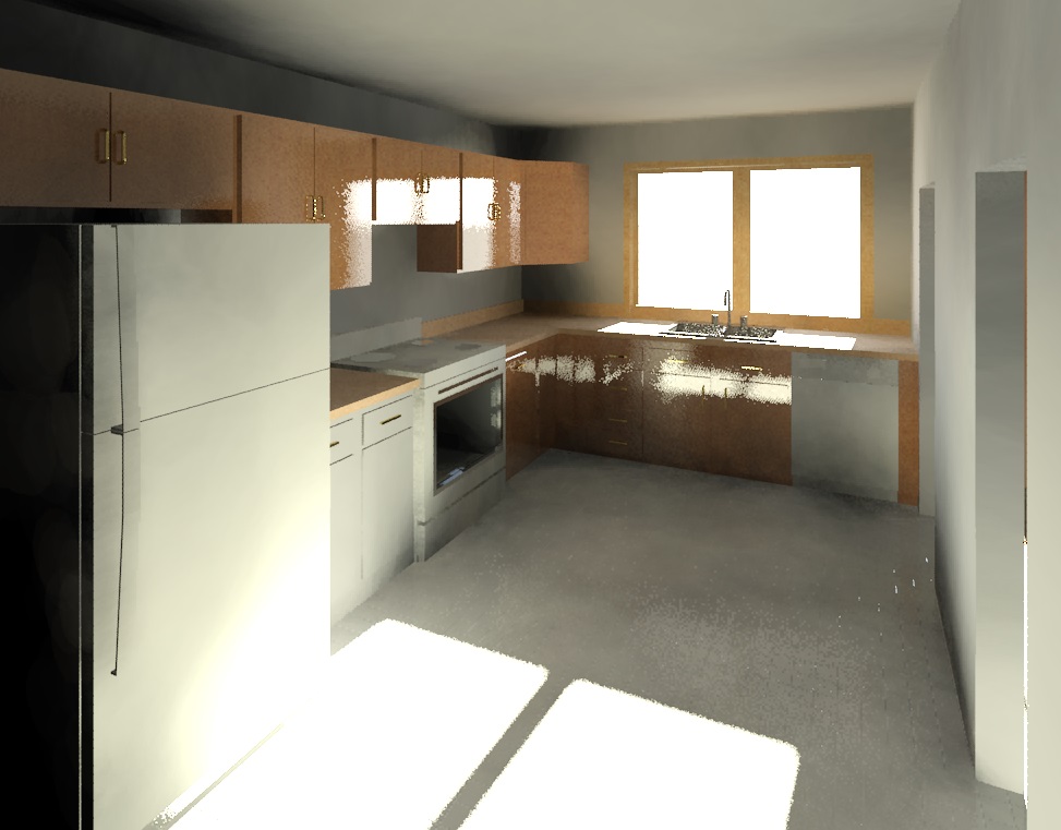
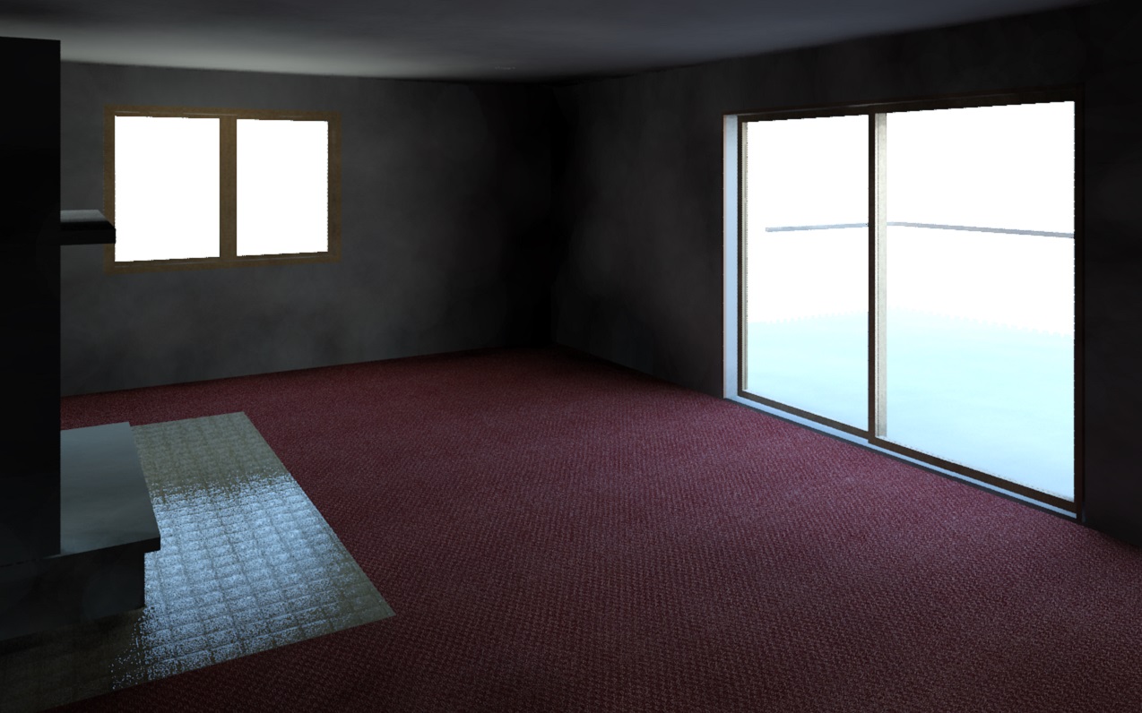
- Provided NYC as-built services by creating complete existing conditions documentation in BIM (building information model).
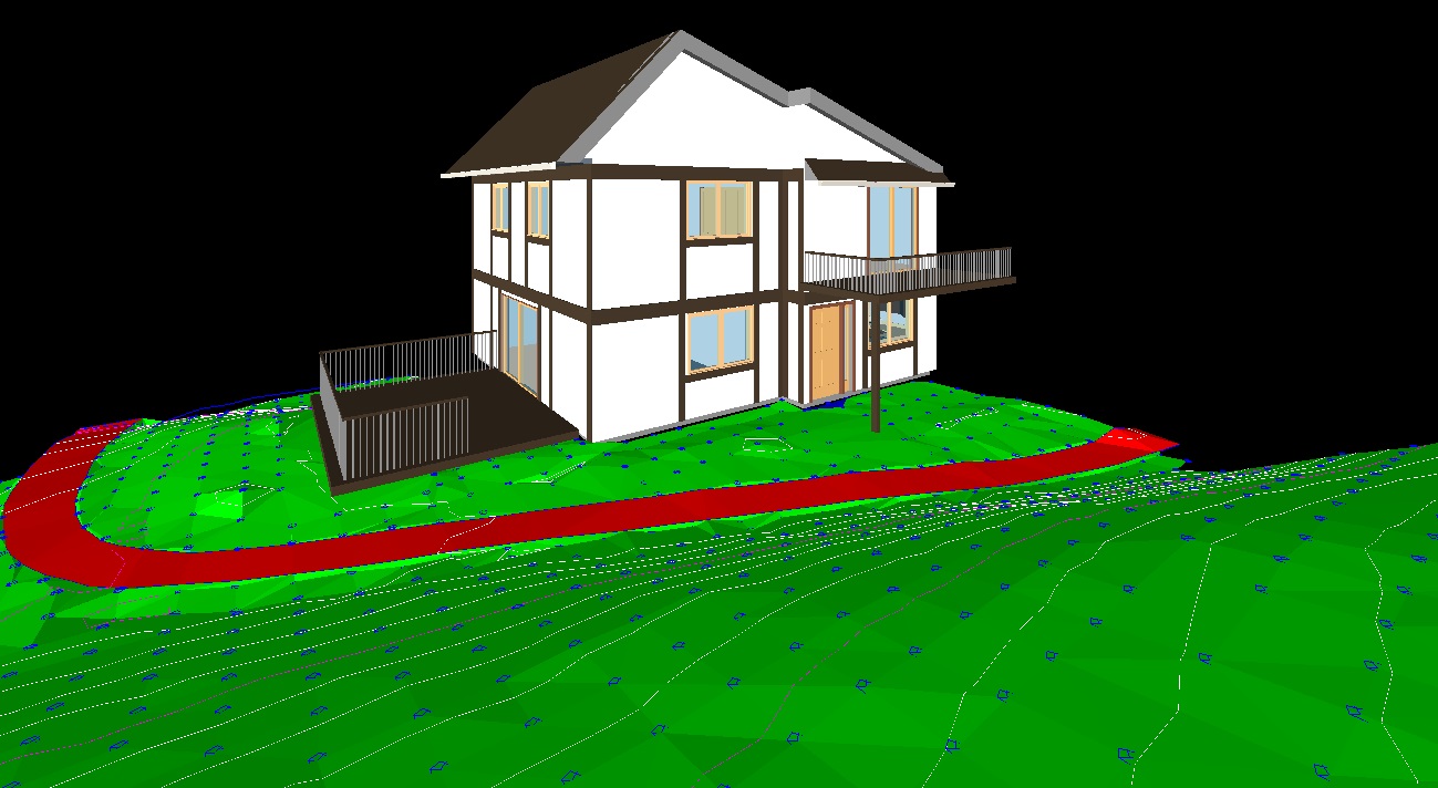
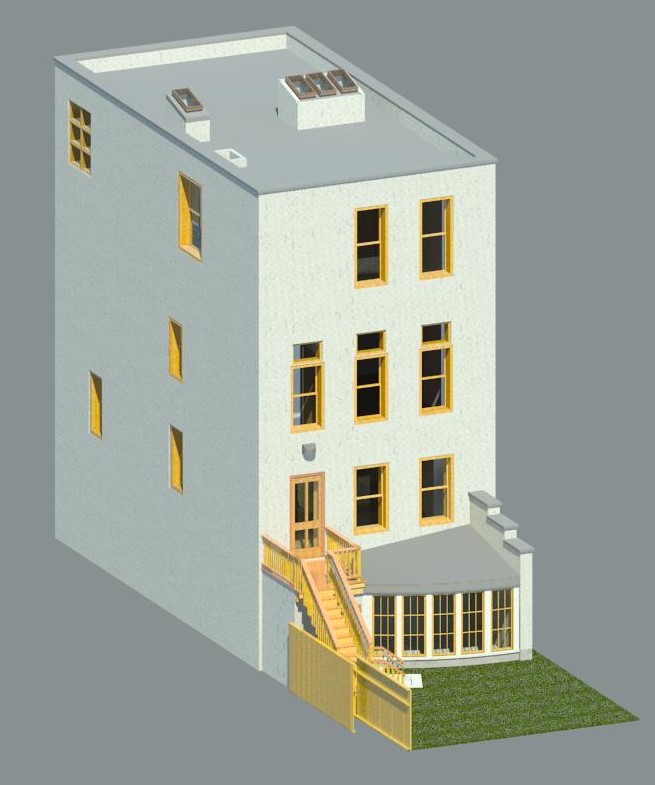
West Chester Avenue (Westchester, NY)
Type: Residential As-Built Projects
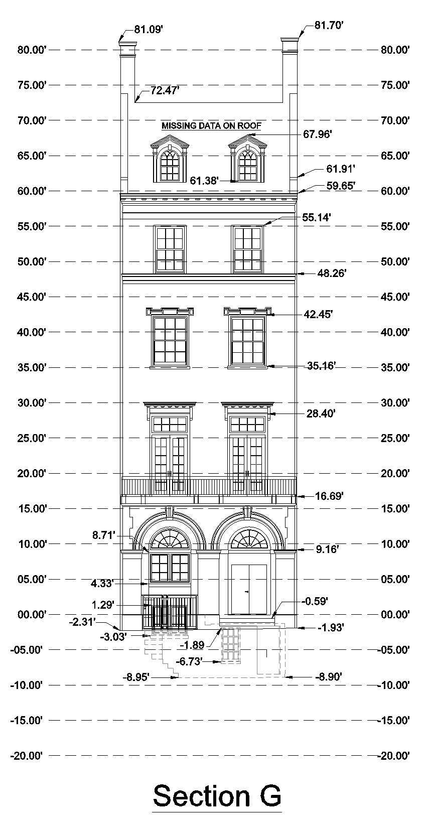
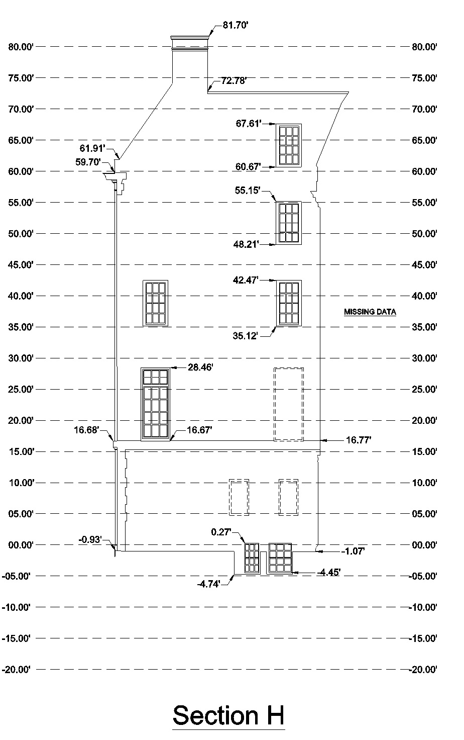
- Provided 3d existing conditions survey for townhouse renovations in West Chester, NY.
- Created complete BIM (building information model) of the entire structure including topography.
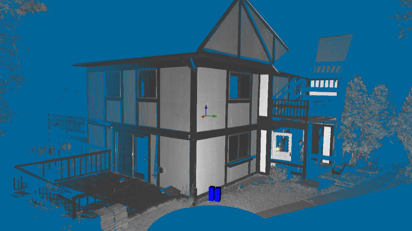
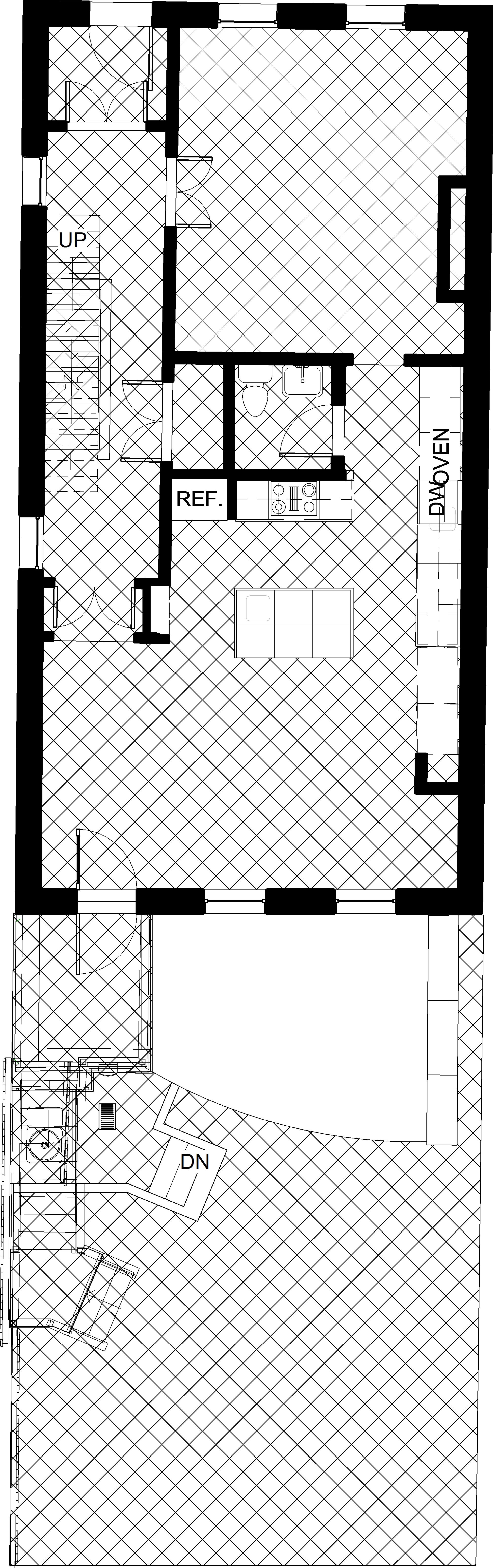
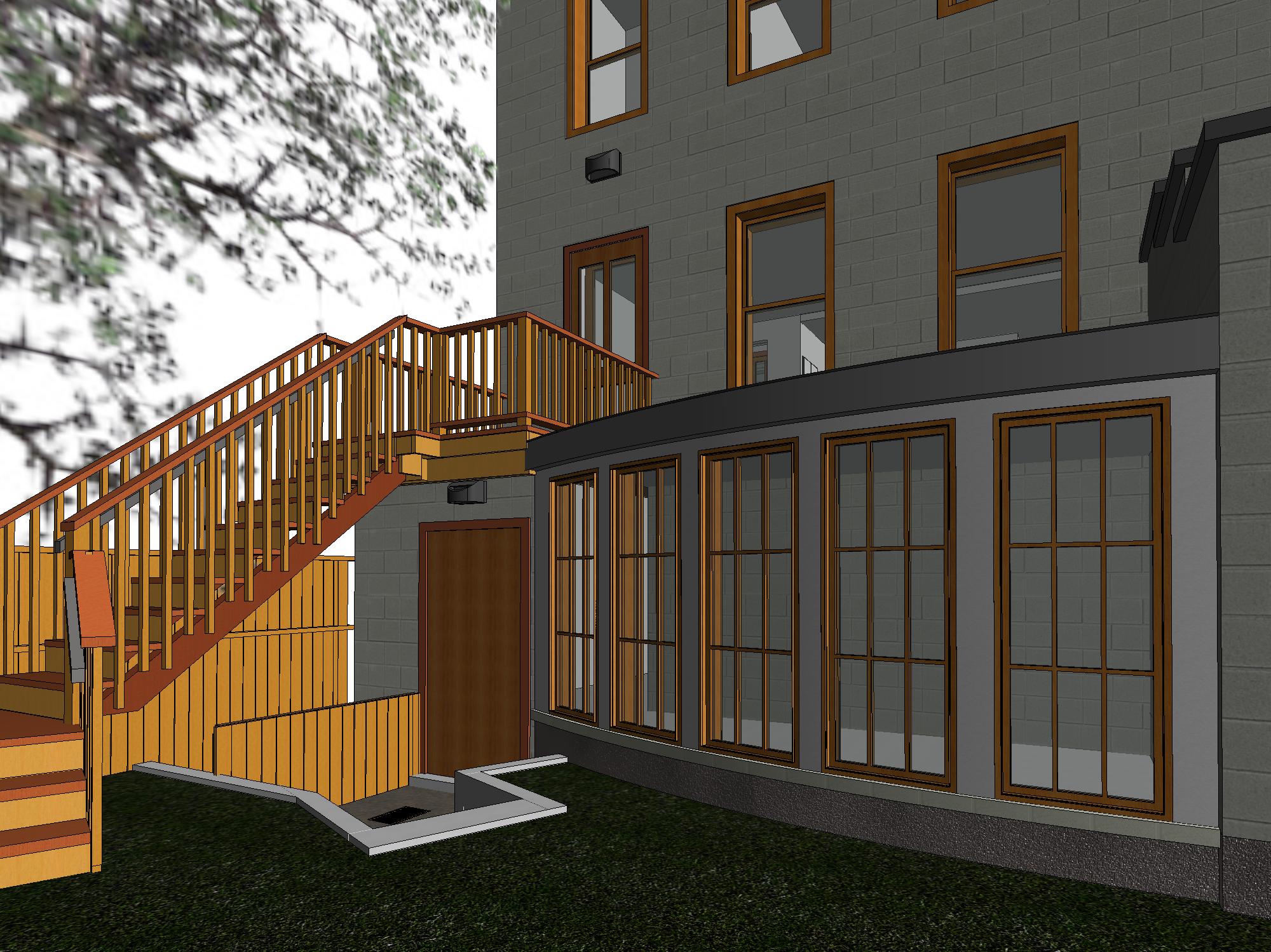
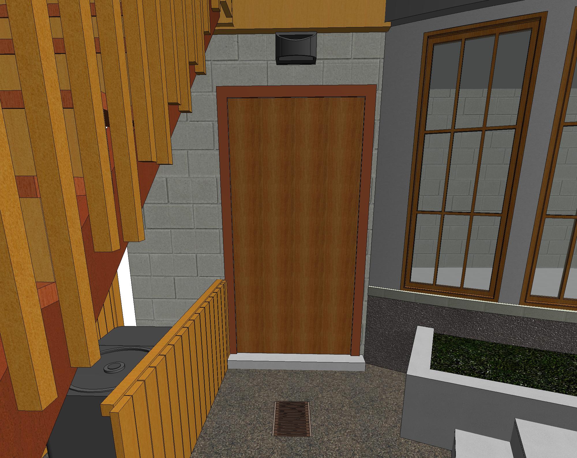
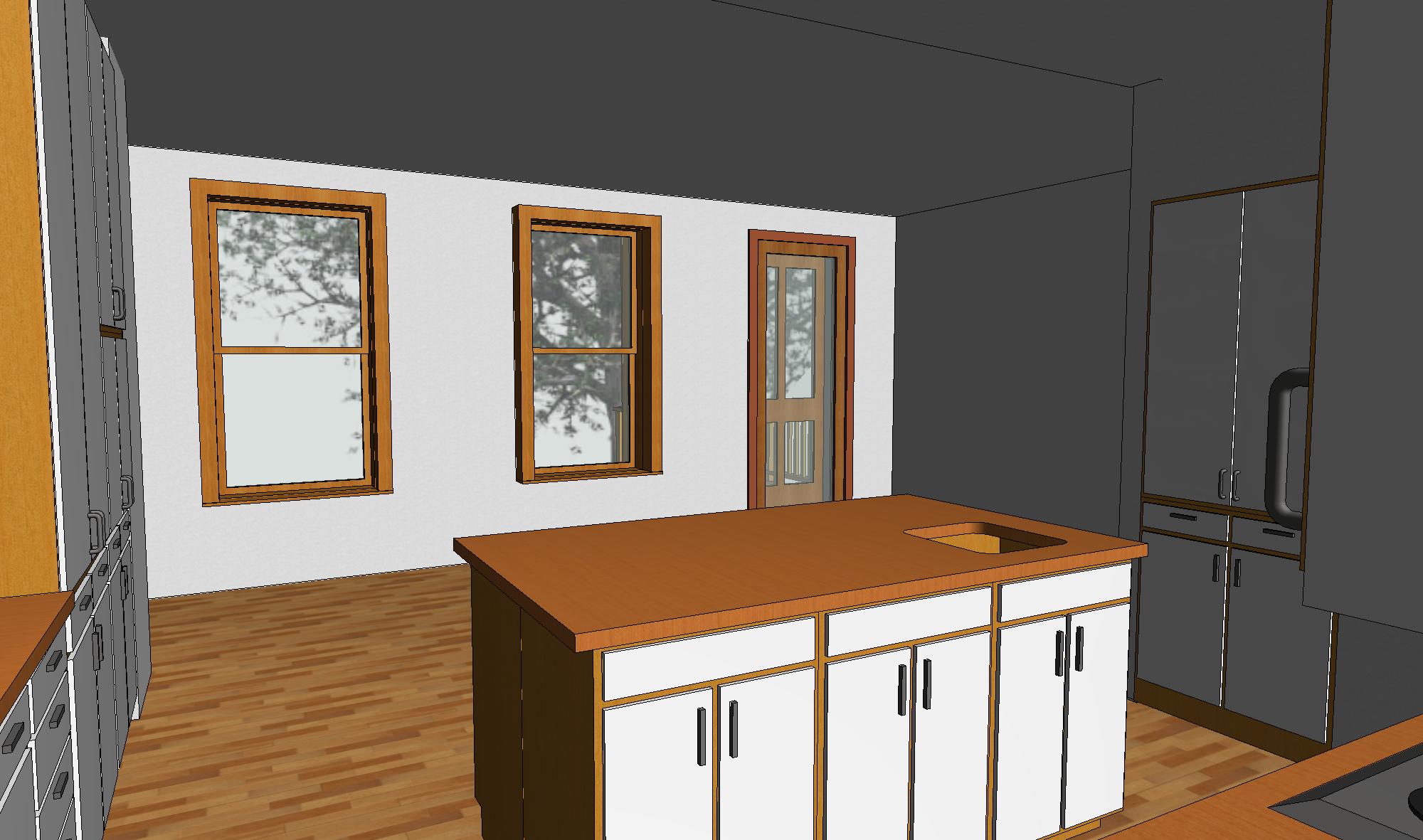
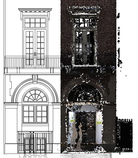
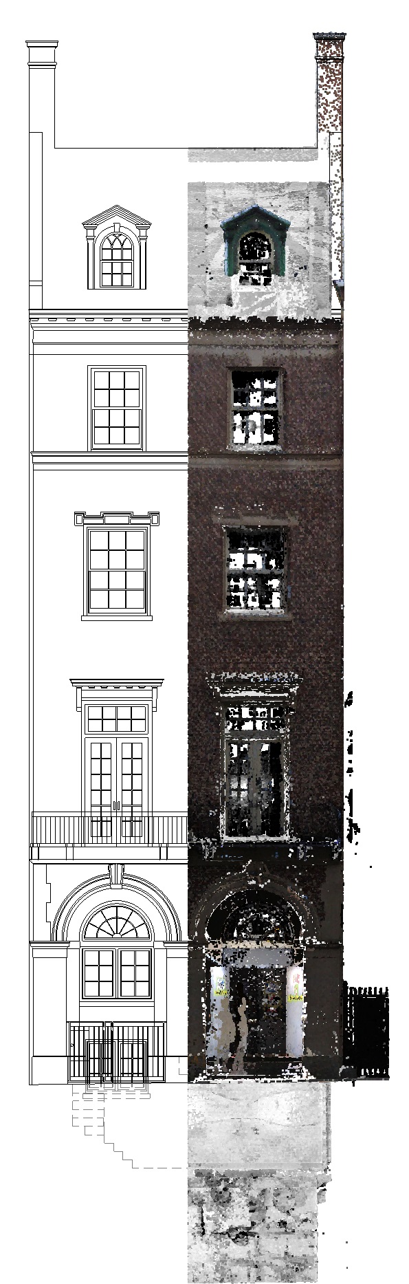
Hudson Street, Hoboken, NJ
Type: Residential As-Built Projects
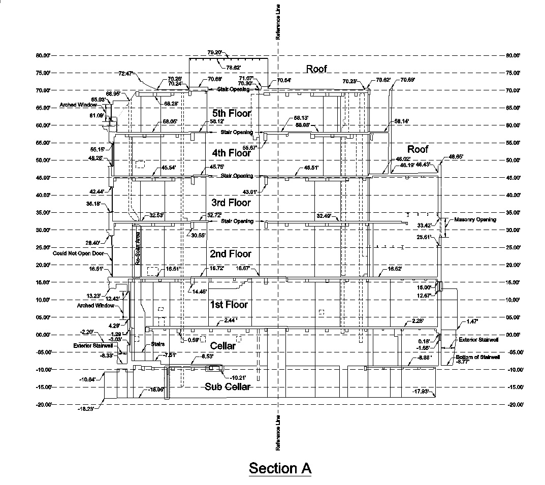
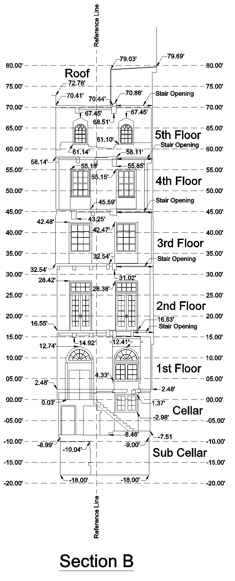
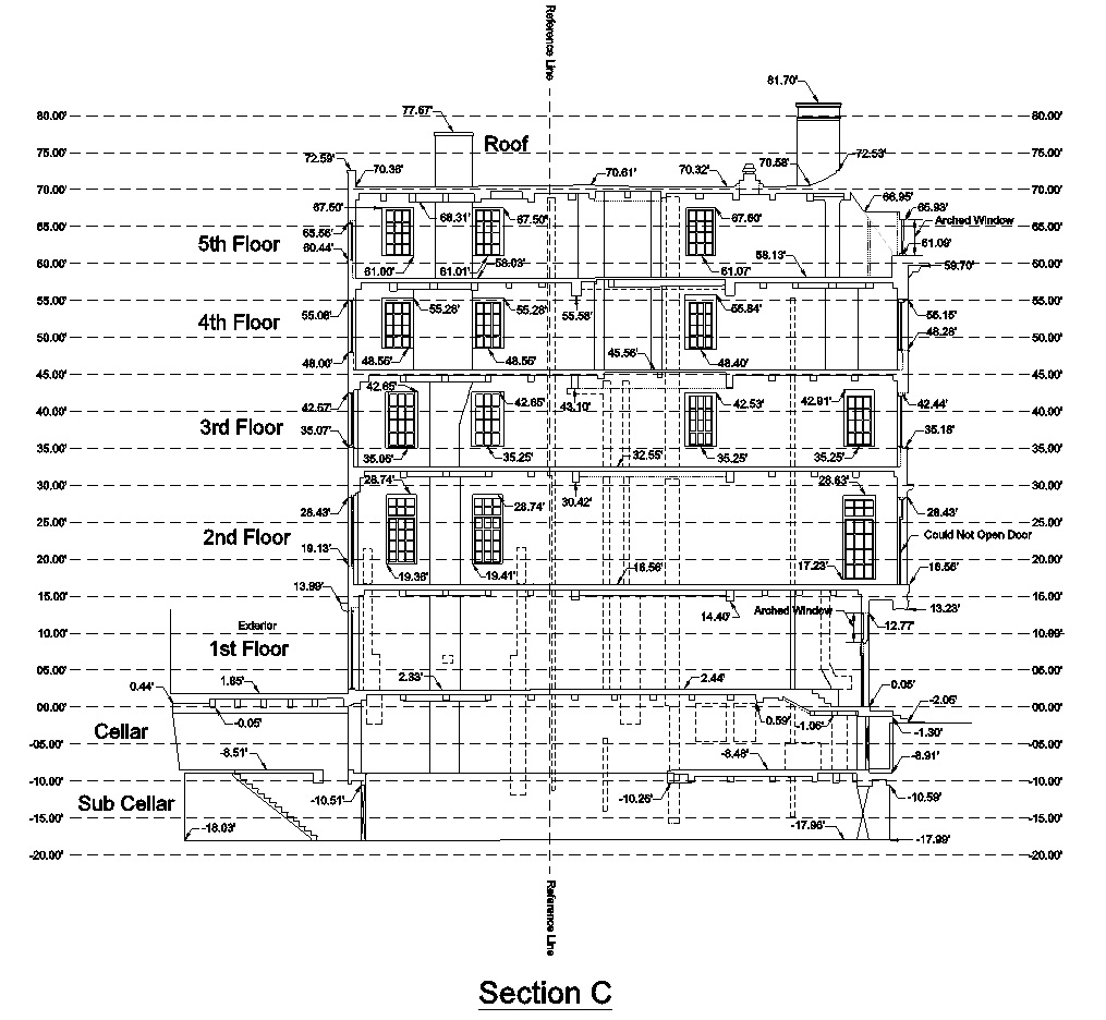
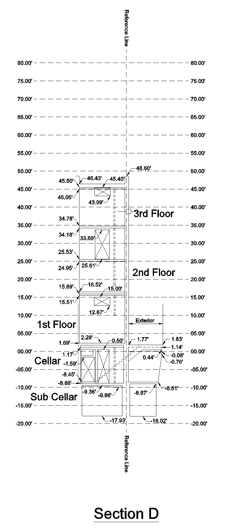
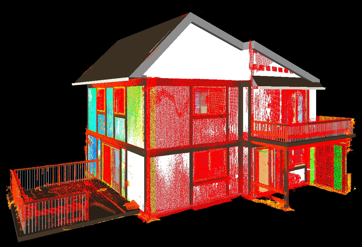
- We provided NJ laser scanning services and an accurate Revit BIM model for a historic building renovation project in Hoboken, NJ.
- The accurate building documentation we provided; facilitated a very successful on-time, and on-budget project.