G&P Associates - Blog
What Tools Are Used to 3D Scan a Property?
Posted: December 1, 2025
What Tools Are Used to 3D Scan a Property? (Complete Guide for As-Built Surveys & Digital Twins)
3D property scanning has become an essential part of modern renovation, design, construction, and real estate workflows. Whether you're an architect documenting existing conditions, a contractor planning a renovation, or a property owner needing accurate measurements, 3D scanning tools provide fast and highly accurate building data.
This guide explains the main tools and technologies used to 3D scan a property, how they work, and when each type is best for your project.
Why 3D Scanning Matters for Renovation and Design
Traditional hand measurements are slow, inconsistent, and prone to error.
3D scanning eliminates guesswork by capturing millions of data points to create:
-
as-built plans
-
point clouds
-
Scan-to-BIM models
-
digital twins
-
measured floor plans
Accurate scanning reduces change orders, improves coordination, and speeds up the design-to-construction process.
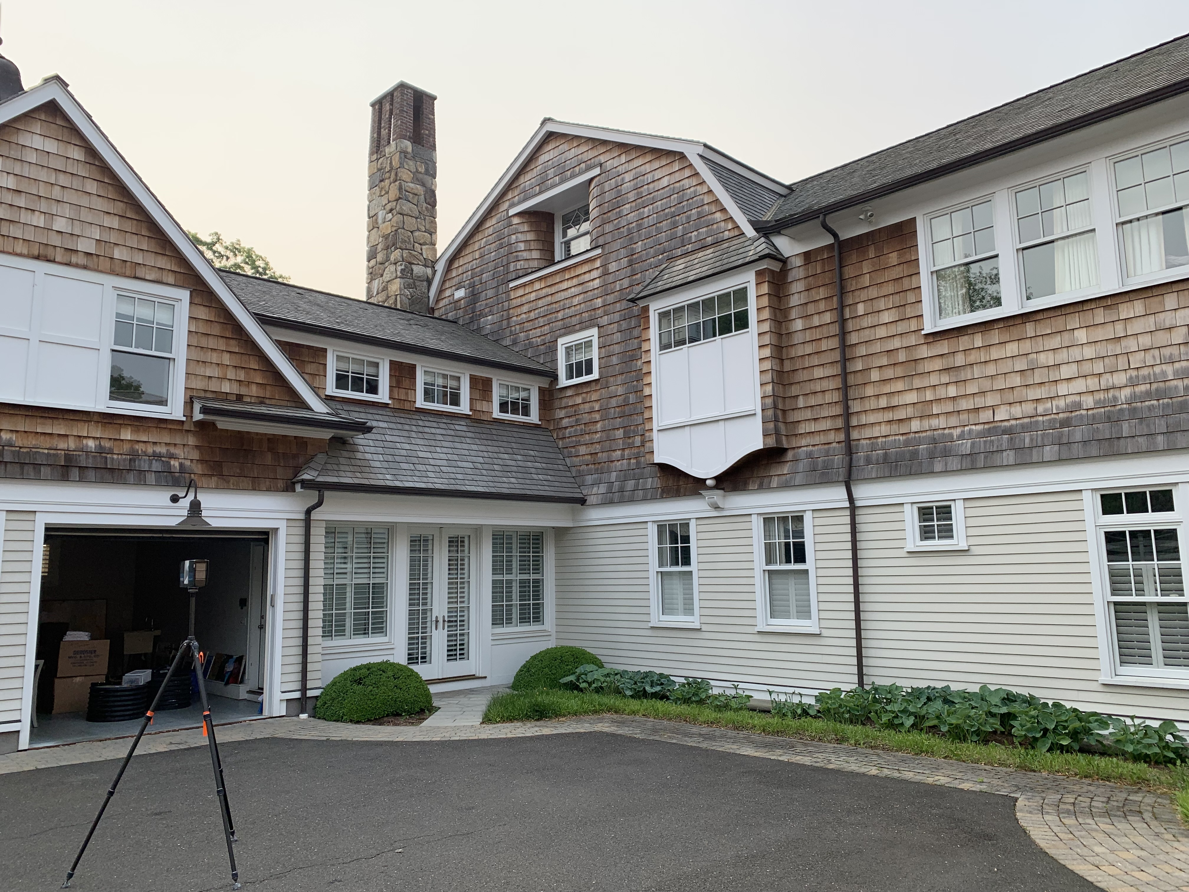
1. Laser Scanners (LiDAR): The Most Accurate 3D Scanning Tools
Laser scanners — often referred to as LiDAR scanners — are the preferred tool for professional as-built surveys, Scan-to-BIM, and existing conditions documentation.
Popular brands include FARO, Leica, Trimble, and GeoSLAM.
How They Work
LiDAR scanners fire laser pulses that bounce off surfaces, capturing precise x,y,z coordinates to form a dense point cloud.
Best For
-
architectural renovation
-
commercial buildings
-
industrial facilities
-
historic structures
-
façade as-builts
-
MEP and structural spaces
-
BIM modeling
Why They’re Used
-
Extremely high accuracy (±1–3 mm)
-
Works indoors and outdoors
-
Captures complex geometry
-
Produces full point clouds compatible with Revit, AutoCAD, and Rhino
Laser scanners are the gold standard for accurate 3D building capture.
2. 3D Cameras (Matterport): Fast and Ideal for Visual Tours
Matterport Pro3 and Matterport Pro2 cameras use a blend of LiDAR/light sensors and panoramic imaging to create visually immersive 3D virtual tours.
Best For
-
real estate listings
-
residential walkthroughs
-
basic interior documentation
-
digital twins with moderate accuracy
Strengths
-
Fast to use
-
Creates an interactive 3D virtual tour
-
Generates measured floor plans
-
Affordable compared to survey-grade scanners
Limitations
-
Not survey-grade (accuracy can be off by inches)
-
Limited outdoor capability
-
Not suitable for BIM-quality as-builts
Matterport is ideal for visualization, but not precise enough for architectural design.
3. Photogrammetry (Cameras & Drones)
Photogrammetry uses overlapping photographs to calculate depth and geometry.
It is often used when capturing:
-
roofs
-
exteriors
-
large sites
-
outdoor areas
-
locations difficult for tripod scanners
Tools Used
-
DSLR/mirrorless cameras
-
drone cameras
-
photogrammetry processing software
Pros
-
Excellent for exterior documentation
-
High-quality textures
-
Adds detail to façade scans
Cons
-
Less accurate than LiDAR
-
Requires good lighting
-
Affected by weather
Photogrammetry is best used alongside laser scanning.
4. Mobile Mapping / Handheld Scanners
Handheld or mobile mapping devices (such as GeoSLAM, NavVis, and Leica BLK2GO) use SLAM technology to “walk and scan” a space.
Best For
-
fast interior documentation
-
warehouses and large open layouts
-
construction progress capture
Pros
-
Very fast capture
-
Portable
-
Good for open or repetitive spaces
Cons
-
Less accurate than tripod LiDAR
-
Not ideal for detailed architectural modeling
Use mobile mapping when speed matters more than millimeter accuracy.
5. Software Tools That Process the 3D Scan Data
Capturing a 3D scan is only half the workflow — software converts scan data into usable deliverables.
Common Software
-
Autodesk Recap (point cloud processing)
-
Revit (Scan-to-BIM modeling)
-
AutoCAD (as-built drafting)
-
Navisworks (coordination)
-
FARO Scene / Leica Cyclone (registration)
-
Matterport Cloud (virtual tours + floor plans)
-
Rhino/IFC import plugins
These tools produce:
-
as-built drawings
-
Scan-to-BIM Revit models
-
floor plans
-
sections & elevations
-
digital twins
Which 3D Scanning Tool Is Best for Your Project?
For Architects
Use LiDAR laser scanners → best accuracy for design and BIM.
For Real Estate Agents
Use Matterport → best for marketing and 3D tours.
For Owners & Developers
Use laser scanning + photogrammetry → ideal for exterior and interior accuracy.
For Construction Teams
Use LiDAR and mobile mapping → best for MEP, layout, and progress monitoring.
For Historic or Complex Buildings
Use FARO or Leica LiDAR → highest detail and reliability.
G&P Associates: Professional 3D Scanning Services Across the Northeast
We use a combination of:
-
FARO LiDAR scanners
-
Matterport Pro3
-
photogrammetry
-
Scan-to-BIM modeling tools
to deliver accurate as-built surveys, point clouds, Revit models, and 3D virtual tours.
Serving NY, NYC, NJ, CT, PA, MD, MA, and the DC Metro Area.
Start Your 3D Scanning Project Today
Get accurate, dependable measurements and digital documentation for your property.
📞 607-327-1106
✉️ cgibbons@gpassociates.org
🌐 https://www.gpassociates.org/contact